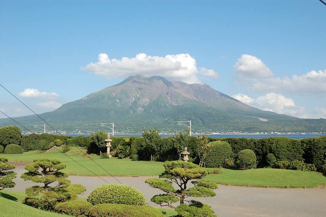
Photo: Hiroaki Kikuchi / CC BY-SA 4.0 · Wikimedia Commons
Kagoshima Prefecture
Kyushu & Okinawa region · Prefecture
Official website
Kagoshima Prefecture in southern Kyushu looks out on Sakurajima, a smoking volcano. The prefecture is long from north to south and extends to Yakushima, Tanegashima and the Amami Islands. It is known for a "black" food culture, such as black pork, black cattle, sweet potatoes and shochu (distilled liquor), and for Meiji Restoration heroes such as Saigo Takamori.
- Sakurajima
- Yakushima and Amami (World Natural Heritage Sites)
- Sweet potato shochu
- Kurobuta (black pork)
Key facts
- Municipalities
- 43 (19 cities, 20 towns, 4 villages)
Source: Statistics Bureau of Japan, 2025 Population Census (population, area and density); area from the Geospatial Information Authority of Japan (GSI), Area Statistics of Prefectures and Municipalities (2025). National ranks are among the 47 prefectures, ordered by this site from these values.
Places to know
- Kagoshima City The prefectural capital, facing Sakurajima.
- Yakushima Town An island where the Jomon Sugi, a cedar that is thousands of years old, still stands.
- Ibusuki City Natural sand-steam baths at a hot spring on the beach.
Current warnings, advisories and earthquakes
Places to visit in Kagoshima Prefecture
Browse by category
Shrines, temples, castles and historic sites
Chosen automatically, most popular first, from landmarks and cultural properties registered in Wikidata (we have not checked whether each is open). Names and descriptions: Wikidata (CC0); photos: Wikimedia Commons (photographer and license under each photo).
National parks in Kagoshima Prefecture
Chosen by overlaying the park boundaries (Ministry of the Environment, Biodiversity Center of Japan, "National Park Areas" GIS data, updated April 28, 2025, combined and simplified by NIPPON ATLAS) with municipal boundaries (National Land Numerical Information, January 2021), keeping overlaps of about 0.5 km² or more (approximate). Areas are the land areas from the Ministry of the Environment, "Overview of National Parks" (April 10, 2026). All national parks
Municipalities in Kagoshima Prefecture (43)
| Municipality | Population | 5-year change | Area | Temperature nownearest AMeDAS |
|---|
| Kagoshima City | 580,549 | −2.1% | 548 km² | |
| Kanoya City | 96,025 | −5.0% | 448 km² | |
| Makurazaki City | 17,922 | −10.5% | 74.75 km² | |
| Akune City | 17,274 | −10.4% | 134 km² | |
| Izumi City | 49,477 | −4.8% | 330 km² | |
| Ibusuki City | 35,793 | −8.2% | 149 km² | |
| Nishinoomote City | 14,183 | −3.6% | 206 km² | |
| Tarumizu City | 12,236 | −11.5% | 162 km² | |
| Satsumasendai City | 87,618 | −5.2% | 683 km² | |
| Hioki City | 44,975 | −4.6% | 253 km² | |
| Soo City | 29,845 | −10.4% | 390 km² | |
| Kirishima City | 120,330 | −2.3% | 603 km² | |
| Ichikikushikino City | 25,401 | −7.6% | 112 km² | |
| Minamisatsuma City | 30,065 | −8.6% | 284 km² | |
| Shibushi City | 27,085 | −7.7% | 290 km² | |
| Amami City | 38,380 | −7.3% | 308 km² | |
| Minamikyushu City | 29,870 | −9.7% | 358 km² | |
| Isa City | 21,375 | −12.6% | 393 km² | |
| Aira City | 76,868 | +0.7% | 231 km² | |
| Mishima Village | 361 | −10.9% | 31.39 km² | |
| Toshima Village | 641 | −13.4% | 101 km² | |
| Satsuma Town | 17,566 | −13.2% | 304 km² | |
| Nagashima Town | 8,648 | −10.9% | 116 km² | |
| Yusui Town | 8,293 | −9.1% | 144 km² | |
| Osaki Town | 11,177 | −9.8% | 101 km² | |
| Higashikushira Town | 5,889 | −5.6% | 27.85 km² | |
| Kinko Town | 5,743 | −17.3% | 163 km² | |
| Minamiosumi Town | 5,346 | −17.5% | 214 km² | |
| Kimotsuki Town | 12,766 | −10.3% | 308 km² | |
| Nakatane Town | 6,832 | −9.4% | 137 km² | |
| Minamitane Town | 4,967 | −8.8% | 110 km² | |
| Yakushima Town | 10,693 | −9.8% | 540 km² | |
| Yamato Village | 1,289 | −5.5% | 88.26 km² | |
| Uken Village | 1,549 | −4.4% | 103 km² | |
| Setouchi Town | 7,651 | −10.5% | 240 km² | |
| Tatsugo Town | 5,678 | −2.4% | 81.82 km² | |
| Kikai Town | 5,970 | −9.9% | 56.82 km² | |
| Tokunoshima Town | 9,284 | −8.5% | 105 km² | |
| Amagi Town | 5,196 | −5.8% | 80.40 km² | |
| Isen Town | 5,405 | −12.0% | 62.71 km² | |
| Wadomari Town | 5,623 | −10.0% | 40.39 km² | |
| Chinacho Town | 5,123 | −10.9% | 53.30 km² | |
| Yoron Town | 4,822 | −5.7% | 20.58 km² | |
Source: Statistics Bureau of Japan, 2025 Population Census (population in 2025; change compared with 2020). Area: GSI (2025). Designated cities are shown as one city (wards combined). "Temperature now" is the latest JMA AMeDAS observation (preliminary) at the nearest station in the same prefecture, loaded and shown unchanged when you open the page.