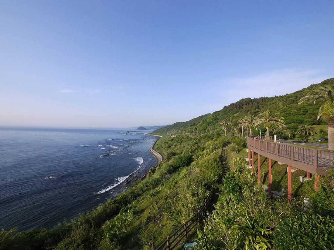
Photo: Ippukucho / CC BY 3.0 · Wikimedia Commons
Miyazaki Prefecture
Kyushu & Okinawa region · Prefecture
Official website
Miyazaki Prefecture has long hours of sunshine and calls itself "Hinata (sunny place) of Japan." It is rich in foods such as mangoes, hyuganatsu citrus, Miyazaki beef and jidori (local chicken), and it is a familiar spring camp site for pro baseball. It is also the land of the Tenson Korin myth (the descent of the sun goddess's grandson from heaven).
- Hinata of Japan
- Mangoes
- Chicken nanban
- Takachiho, a land of myths
Key facts
- Municipalities
- 26 (9 cities, 14 towns, 3 villages)
Source: Statistics Bureau of Japan, 2025 Population Census (population, area and density); area from the Geospatial Information Authority of Japan (GSI), Area Statistics of Prefectures and Municipalities (2025). National ranks are among the 47 prefectures, ordered by this site from these values.
Places to know
- Miyazaki City Aoshima, with its tropical atmosphere, and the "Devil's Washboard" rocks.
- Takachiho Town Takachiho Gorge and yokagura (sacred dances performed at night).
- Nichinan City The castle town of Obi and Udo Jingu, a shrine on a cliff.
Current warnings, advisories and earthquakes
Places to visit in Miyazaki Prefecture
 Island · Miyazaki CityAoshimaisland in Japan
 Valley · Takachiho TownTakachihokyo Gorge
 Special historic site · Saito CitySaitobaru Kofun ClusterMegalithic tombs in Miyazaki, Japan
 Shinto shrine · Nichinan City, MiyazakiUdo JinguShinto shrine in Miyazaki Prefecture, Japan
 Castle · Nichinan City, MiyazakiObi CastleJapanese castle in Nichinan, Miyazaki prefecture
 Historic townscape · Nichinan City, MiyazakiObiarea in Nichinan city, Miyazaki prefecture, Japan
 Shinto shrine · Miyazaki CityMiyazaki JinguShinto shrine in Miyazaki Prefecture, Japan
 Shinto shrine · Takachiho TownTakachiho ShrineShinto shrine in Miyazaki Prefecture, Japan
 Castle · Miyazaki CitySadowara CastleJapanese castle in Miyazaki city, Miyazaki prefecture
 Island · Kushima CityTsukishima island
Browse by category
Shrines, temples, castles and historic sites
Chosen automatically, most popular first, from landmarks and cultural properties registered in Wikidata (we have not checked whether each is open). Names and descriptions: Wikidata (CC0); photos: Wikimedia Commons (photographer and license under each photo).
National parks in Miyazaki Prefecture
Chosen by overlaying the park boundaries (Ministry of the Environment, Biodiversity Center of Japan, "National Park Areas" GIS data, updated April 28, 2025, combined and simplified by NIPPON ATLAS) with municipal boundaries (National Land Numerical Information, January 2021), keeping overlaps of about 0.5 km² or more (approximate). Areas are the land areas from the Ministry of the Environment, "Overview of National Parks" (April 10, 2026). All national parks
Municipalities in Miyazaki Prefecture (26)
| Municipality | Population | 5-year change | Area | Temperature nownearest AMeDAS |
|---|
| Miyazaki City | 389,588 | −2.9% | 644 km² | |
| Miyakonojo City | 159,699 | −0.6% | 653 km² | |
| Nobeoka City | 109,504 | −7.5% | 868 km² | |
| Nichinan City | 45,850 | −9.8% | 535 km² | |
| Kobayashi City | 40,003 | −8.4% | 563 km² | |
| Hyuga City | 56,040 | −6.0% | 337 km² | |
| Kushima City | 14,772 | −12.2% | 295 km² | |
| Saito City | 26,565 | −7.1% | 439 km² | |
| Ebino City | 15,597 | −11.6% | 283 km² | |
| Mimata Town | 24,964 | −2.5% | 110 km² | |
| Takaharu Town | 7,689 | −11.0% | 85.39 km² | |
| Kunitomi Town | 17,531 | −4.7% | 131 km² | |
| Aya Town | 6,497 | −6.3% | 95.19 km² | |
| Takanabe Town | 18,662 | −6.3% | 43.80 km² | |
| Shintomi Town | 15,782 | −4.7% | 61.48 km² | |
| Nishimera Village | 894 | −10.6% | 272 km² | |
| Kijo Town | 4,465 | −8.8% | 146 km² | |
| Kawaminami Town | 14,025 | −7.7% | 90.13 km² | |
| Tsuno Town | 9,344 | −5.7% | 102 km² | |
| Kadogawa Town | 16,137 | −7.1% | 120 km² | |
| Morotsuka Village | 1,260 | −15.2% | 188 km² | |
| Shiiba Village | 2,176 | −13.1% | 537 km² | |
| Misato Town | 4,092 | −15.2% | 449 km² | |
| Takachiho Town | 10,366 | −11.0% | 238 km² | |
| Hinokage Town | 3,115 | −14.3% | 278 km² | |
| Gokase Town | 3,011 | −13.3% | 172 km² | |
Source: Statistics Bureau of Japan, 2025 Population Census (population in 2025; change compared with 2020). Area: GSI (2025). Designated cities are shown as one city (wards combined). "Temperature now" is the latest JMA AMeDAS observation (preliminary) at the nearest station in the same prefecture, loaded and shown unchanged when you open the page.