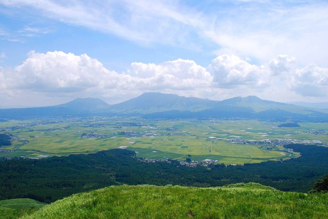
Photo: Miya.m / CC BY-SA 3.0 · Wikimedia Commons
Kumamoto Prefecture
Kyushu & Okinawa region · Prefecture
Official website
Kumamoto Prefecture is the "Land of Fire," blessed with Mt. Aso, which has one of the largest calderas (volcanic basins) in the world, and with abundant groundwater. Kumamoto City is a rare city in Japan that supplies all of its tap water from groundwater. The prefecture's production of tomatoes and watermelons ranks 1st in Japan.
- Mt. Aso
- Kumamoto Castle
- Kumamon
- Basashi (raw horse meat)
Key facts
- Municipalities
- 45 (14 cities, 23 towns, 8 villages)
Source: Statistics Bureau of Japan, 2025 Population Census (population, area and density); area from the Geospatial Information Authority of Japan (GSI), Area Statistics of Prefectures and Municipalities (2025). National ranks are among the 47 prefectures, ordered by this site from these values.
Places to know
- Kumamoto City Kumamoto Castle, one of the Three Great Castles of Japan, and the Suizen-ji Joju-en garden.
- Aso City The crater of Mt. Naka at Aso and vast grasslands.
- Amakusa City Dolphin watching in the Amakusa Islands, and Sakitsu Village.
Current warnings, advisories and earthquakes
Places to visit in Kumamoto Prefecture
 Castle · Kumamoto CityKumamoto Castlecastle
 Bridge · Yamato Town, KumamotoTsujun Bridgebridge in Japan
 Shopping center · Kashima Town, KumamotoAEON Mall Kumamotobuilding in Kashima, Kumamoto Prefecture, Japan
 Shinto shrine · Aso CityAso ShrineShinto shrine in Aso, Kumamoto prefecture, Japan
 Shinto shrine · Hitoyoshi CityAoi Aso ShrineShinto shrine in Kumamoto Prefecture, Japan
 Garden · Kumamoto CitySuizen-ji Joju-enJapanese garden located in Suizen-ji Park
 Castle · Yatsushiro CityYatsushiro Castlecastle in Kumamoto, Japan
 Burial mound (kofun) · Nagomi TownEta Funayama KofunBurial mound in Japan
 Castle · Hitoyoshi CityHitoyoshi CastleJapanese castle in Hitoyoshi, Kumamoto prefecture
 Hot spring (onsen) · Minamioguni TownKurokawa Onsenbuilding in Kumamoto Prefecture, Japan
Browse by category
Shrines, temples, castles and historic sites
Chosen automatically, most popular first, from landmarks and cultural properties registered in Wikidata (we have not checked whether each is open). Names and descriptions: Wikidata (CC0); photos: Wikimedia Commons (photographer and license under each photo).
National parks in Kumamoto Prefecture
Chosen by overlaying the park boundaries (Ministry of the Environment, Biodiversity Center of Japan, "National Park Areas" GIS data, updated April 28, 2025, combined and simplified by NIPPON ATLAS) with municipal boundaries (National Land Numerical Information, January 2021), keeping overlaps of about 0.5 km² or more (approximate). Areas are the land areas from the Ministry of the Environment, "Overview of National Parks" (April 10, 2026). All national parks
Municipalities in Kumamoto Prefecture (45)
| Municipality | Population | 5-year change | Area | Temperature nownearest AMeDAS |
|---|
| Kumamoto City | 730,882 | −1.1% | 390 km² | |
| Yatsushiro City | 115,362 | −6.3% | 681 km² | |
| Hitoyoshi City | 28,779 | −7.5% | 211 km² | |
| Arao City | 47,306 | −6.9% | 57.37 km² | |
| Minamata City | 20,782 | −11.8% | 163 km² | |
| Tamana City | 60,524 | −5.9% | 152 km² | |
| Yamaga City | 45,496 | −7.2% | 300 km² | |
| Kikuchi City | 44,706 | −3.7% | 277 km² | |
| Uto City | 34,542 | −4.4% | 74.30 km² | |
| Kamiamakusa City | 21,389 | −12.9% | 127 km² | |
| Uki City | 54,513 | −4.4% | 189 km² | |
| Aso City | 22,927 | −8.0% | 376 km² | |
| Amakusa City | 68,028 | −10.2% | 684 km² | |
| Koshi City | 64,314 | +4.1% | 53.19 km² | |
| Misato Town | 8,030 | −14.5% | 144 km² | |
| Gyokuto Town | 4,864 | −3.6% | 24.33 km² | |
| Nankan Town | 8,068 | −10.1% | 69.18 km² | |
| Nagasu Town | 14,534 | −5.5% | 19.44 km² | |
| Nagomi Town | 8,462 | −9.4% | 98.78 km² | |
| Ozu Town | 36,915 | +4.9% | 99.10 km² | |
| Kikuyo Town | 44,532 | +2.8% | 37.46 km² | |
| Minamioguni Town | 3,462 | −7.7% | 116 km² | |
| Oguni Town | 5,865 | −11.0% | 137 km² | |
| Ubuyama Village | 1,190 | −13.9% | 60.81 km² | |
| Takamori Town | 5,363 | −7.4% | 175 km² | |
| Nishihara Village | 6,826 | +6.2% | 77.22 km² | |
| Minamiaso Village | 9,164 | −6.8% | 137 km² | |
| Mifune Town | 16,527 | +1.4% | 99.03 km² | |
| Kashima Town | 10,080 | +5.6% | 16.65 km² | |
| Mashiki Town | 33,519 | +3.1% | 65.68 km² | |
| Kosa Town | 9,433 | −6.9% | 57.93 km² | |
| Yamato Town | 11,665 | −13.6% | 545 km² | |
| Hikawa Town | 9,972 | −10.1% | 33.31 km² | |
| Ashikita Town | 13,867 | −11.6% | 234 km² | |
| Tsunagi Town | 3,811 | −10.4% | 34.08 km² | |
| Nishiki Town | 9,611 | −6.6% | 85.04 km² | |
| Taragi Town | 7,867 | −13.3% | 166 km² | |
| Yunomae Town | 3,251 | −10.4% | 48.37 km² | |
| Mizukami Village | 1,779 | −12.5% | 191 km² | |
| Sagara Village | 3,768 | −7.4% | 94.54 km² | |
| Itsuki Village | 812 | −12.8% | 253 km² | |
| Yamae Village | 2,914 | −10.0% | 121 km² | |
| Kuma Village | 2,263 | −7.0% | 208 km² | |
| Asagiri Town | 13,188 | −10.1% | 160 km² | |
| Reihoku Town | 6,150 | −13.6% | 67.58 km² | |
Source: Statistics Bureau of Japan, 2025 Population Census (population in 2025; change compared with 2020). Area: GSI (2025). Designated cities are shown as one city (wards combined). "Temperature now" is the latest JMA AMeDAS observation (preliminary) at the nearest station in the same prefecture, loaded and shown unchanged when you open the page.