Photo: Fg2 / Public domain · Wikimedia Commons
Nagasaki Prefecture
Kyushu & Okinawa region · Prefecture
Official website
Nagasaki Prefecture has many islands and a long, intricate coastline. Even during the period of national isolation (sakoku), it remained open to other countries through Dejima and developed a unique culture that mixes Japanese, Chinese and Dutch elements. The history of the Hidden Christians (who kept their faith in secret) also remains strong.
- Dejima
- Hidden Christian Sites (World Cultural Heritage Site)
- Gunkanjima (Hashima Island)
- Champon noodles and castella cake
Key facts
- Municipalities
- 21 (13 cities, 8 towns)
Source: Statistics Bureau of Japan, 2025 Population Census (population, area and density); area from the Geospatial Information Authority of Japan (GSI), Area Statistics of Prefectures and Municipalities (2025). National ranks are among the 47 prefectures, ordered by this site from these values.
Places to know
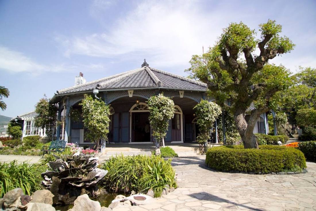
- Nagasaki City Glover Garden, the Peace Park and one of the World's New Three Major Night Views.
- Sasebo City Huis Ten Bosch, the Kujuku Islands and the Sasebo burger.
- Goto City The Goto Islands, with their churches and beautiful sea.
Current warnings, advisories and earthquakes
Places to visit in Nagasaki Prefecture
Browse by category
Shrines, temples, castles and historic sites
Chosen automatically, most popular first, from landmarks and cultural properties registered in Wikidata (we have not checked whether each is open). Names and descriptions: Wikidata (CC0); photos: Wikimedia Commons (photographer and license under each photo).
National parks in Nagasaki Prefecture
Chosen by overlaying the park boundaries (Ministry of the Environment, Biodiversity Center of Japan, "National Park Areas" GIS data, updated April 28, 2025, combined and simplified by NIPPON ATLAS) with municipal boundaries (National Land Numerical Information, January 2021), keeping overlaps of about 0.5 km² or more (approximate). Areas are the land areas from the Ministry of the Environment, "Overview of National Parks" (April 10, 2026). All national parks
Municipalities in Nagasaki Prefecture (21)
| Municipality | Population | 5-year change | Area | Temperature nownearest AMeDAS |
|---|
| Nagasaki City | 382,393 | −6.5% | 406 km² | |
| Sasebo City | 225,977 | −7.1% | 426 km² | |
| Shimabara City | 40,416 | −6.7% | 82.96 km² | |
| Isahaya City | 130,092 | −2.8% | 342 km² | |
| Omura City | 97,445 | +2.1% | 127 km² | |
| Hirado City | 26,396 | −10.1% | 235 km² | |
| Matsuura City | 19,295 | −9.3% | 131 km² | |
| Tsushima City | 25,310 | −11.2% | 707 km² | |
| Iki City | 22,306 | −10.6% | 139 km² | |
| Goto City | 31,441 | −8.6% | 420 km² | |
| Saikai City | 23,433 | −10.8% | 242 km² | |
| Unzen City | 38,184 | −7.1% | 214 km² | |
| Minamishimabara City | 37,325 | −11.8% | 170 km² | |
| Nagayo Town | 38,712 | −5.1% | 28.73 km² | |
| Togitsu Town | 28,949 | −1.3% | 20.94 km² | |
| Higashisonogi Town | 7,124 | −7.7% | 74.29 km² | |
| Kawatana Town | 12,312 | −8.0% | 37.25 km² | |
| Hasami Town | 13,705 | −4.1% | 56.00 km² | |
| Ojika Town | 2,016 | −11.9% | 25.50 km² | |
| Saza Town | 13,691 | −1.6% | 32.26 km² | |
| Shinkamigoto Town | 15,518 | −11.3% | 214 km² | |
Source: Statistics Bureau of Japan, 2025 Population Census (population in 2025; change compared with 2020). Area: GSI (2025). Designated cities are shown as one city (wards combined). "Temperature now" is the latest JMA AMeDAS observation (preliminary) at the nearest station in the same prefecture, loaded and shown unchanged when you open the page.