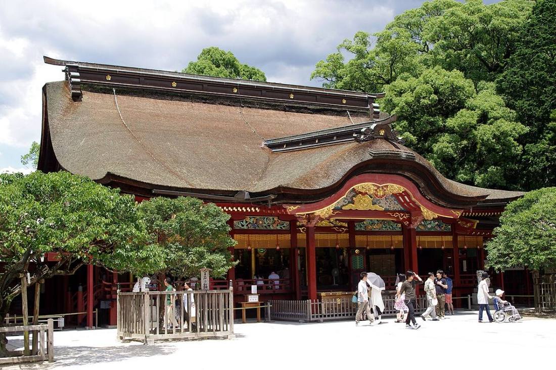
Photo: Jakub Hałun / CC BY-SA 4.0 · Wikimedia Commons
Fukuoka Prefecture
Kyushu & Okinawa region · Prefecture
Official website
Fukuoka Prefecture is the economic and cultural center of Kyushu and has 2 designated cities (large cities with special status): Fukuoka and Kitakyushu. Its food culture of yatai (street food stalls), tonkotsu (pork bone) ramen, mentaiko (spicy pollock roe) and motsunabe (offal hot pot) is famous. The government-run Yawata Steel Works became a foundation of modern Japanese industry.
- Hakata ramen and mentaiko
- Dazaifu Tenmangu
- Munakata and Okinoshima (World Cultural Heritage Site)
- Hakata Gion Yamakasa
Key facts
- Municipalities
- 60 (29 cities, 29 towns, 2 villages)
Source: Statistics Bureau of Japan, 2025 Population Census (population, area and density); area from the Geospatial Information Authority of Japan (GSI), Area Statistics of Prefectures and Municipalities (2025). National ranks are among the 47 prefectures, ordered by this site from these values.
Places to know
- Fukuoka City Population about 1.66 million. Yatai food stalls in Nakasu and a gateway to Asia.
- Kitakyushu City The Yawata Steel Works and Mojiko Retro.
- Dazaifu City Dazaifu Tenmangu, which enshrines Sugawara no Michizane, the god of learning.
Current warnings, advisories and earthquakes
Places to visit in Fukuoka Prefecture
Browse by category
Shrines, temples, castles and historic sites
Chosen automatically, most popular first, from landmarks and cultural properties registered in Wikidata (we have not checked whether each is open). Names and descriptions: Wikidata (CC0); photos: Wikimedia Commons (photographer and license under each photo).
Municipalities in Fukuoka Prefecture (60)
| Municipality | Population | 5-year change | Area | Temperature nownearest AMeDAS |
|---|
| Kitakyushu City | 903,592 | −3.8% | 492 km² | |
| Fukuoka City | 1,662,793 | +3.1% | 343 km² | |
| Omuta City | 101,874 | −8.5% | 81.45 km² | |
| Kurume City | 296,599 | −2.2% | 230 km² | |
| Nogata City | 53,586 | −4.7% | 61.76 km² | |
| Iizuka City | 122,190 | −3.3% | 214 km² | |
| Tagawa City | 44,206 | −4.3% | 54.55 km² | |
| Yanagawa City | 60,427 | −6.3% | 77.15 km² | |
| Yame City | 57,318 | −5.4% | 482 km² | |
| Chikugo City | 47,668 | −2.4% | 41.78 km² | |
| Okawa City | 29,705 | −10.0% | 33.62 km² | |
| Yukuhashi City | 70,046 | −1.9% | 69.95 km² | |
| Buzen City | 22,253 | −8.8% | 111 km² | |
| Nakama City | 38,408 | −4.8% | 15.96 km² | |
| Ogori City | 58,390 | −1.6% | 45.51 km² | |
| Chikushino City | 105,844 | +2.5% | 87.73 km² | |
| Kasuga City | 108,955 | −1.9% | 14.15 km² | |
| Onojo City | 103,552 | +1.4% | 26.89 km² | |
| Munakata City | 96,873 | −0.2% | 120 km² | |
| Dazaifu City | 72,777 | −0.5% | 29.60 km² | |
| Koga City | 58,311 | −0.8% | 42.07 km² | |
| Fukutsu City | 69,013 | +3.0% | 52.76 km² | |
| Ukiha City | 25,921 | −7.4% | 117 km² | |
| Miyawaka City | 24,070 | −8.5% | 140 km² | |
| Kama City | 31,871 | −10.2% | 135 km² | |
| Asakura City | 47,362 | −5.8% | 247 km² | |
| Miyama City | 32,979 | −8.0% | 105 km² | |
| Itoshima City | 100,614 | +1.8% | 216 km² | |
| Nakagawa City | 47,766 | −4.7% | 74.95 km² | |
| Umi Town | 37,212 | −1.2% | 30.21 km² | |
| Sasaguri Town | 31,088 | −0.4% | 38.93 km² | |
| Shime Town | 45,383 | −2.1% | 8.69 km² | |
| Sue Town | 29,051 | +1.5% | 16.31 km² | |
| Shingu Town | 32,185 | −2.3% | 18.93 km² | |
| Hisayama Town | 9,246 | +2.0% | 37.44 km² | |
| Kasuya Town | 48,490 | +0.6% | 14.13 km² | |
| Ashiya Town | 12,289 | −9.3% | 11.58 km² | |
| Mizumaki Town | 27,627 | −1.7% | 11.01 km² | |
| Okagaki Town | 30,410 | −1.9% | 48.64 km² | |
| Onga Town | 18,391 | −1.8% | 22.15 km² | |
| Kotake Town | 6,527 | −8.7% | 14.28 km² | |
| Kurate Town | 14,022 | −7.0% | 35.60 km² | |
| Keisen Town | 12,203 | −5.2% | 20.14 km² | |
| Chikuzen Town | 30,863 | +4.3% | 67.10 km² | |
| Toho Village | 1,616 | −14.9% | 51.97 km² | |
| Tachiarai Town | 15,784 | +1.7% | 22.84 km² | |
| Oki Town | 13,166 | −4.7% | 18.44 km² | |
| Hirokawa Town | 19,249 | −3.6% | 37.94 km² | |
| Kawara Town | 9,332 | −8.4% | 44.50 km² | |
| Soeda Town | 7,617 | −13.5% | 132 km² | |
| Itoda Town | 7,542 | −10.3% | 8.04 km² | |
| Kawasaki Town | 13,461 | −11.3% | 36.14 km² | |
| Oto Town | 4,772 | −4.7% | 14.26 km² | |
| Aka Village | 2,492 | −10.2% | 31.98 km² | |
| Fukuchi Town | 19,849 | −7.2% | 42.06 km² | |
| Kanda Town | 37,952 | +0.7% | 49.52 km² | |
| Miyako Town | 16,721 | −11.2% | 151 km² | |
| Yoshitomi Town | 6,247 | −4.4% | 5.73 km² | |
| Koge Town | 6,675 | −7.9% | 62.44 km² | |
| Chikujo Town | 15,360 | −10.6% | 120 km² | |
Source: Statistics Bureau of Japan, 2025 Population Census (population in 2025; change compared with 2020). Area: GSI (2025). Designated cities are shown as one city (wards combined). "Temperature now" is the latest JMA AMeDAS observation (preliminary) at the nearest station in the same prefecture, loaded and shown unchanged when you open the page.