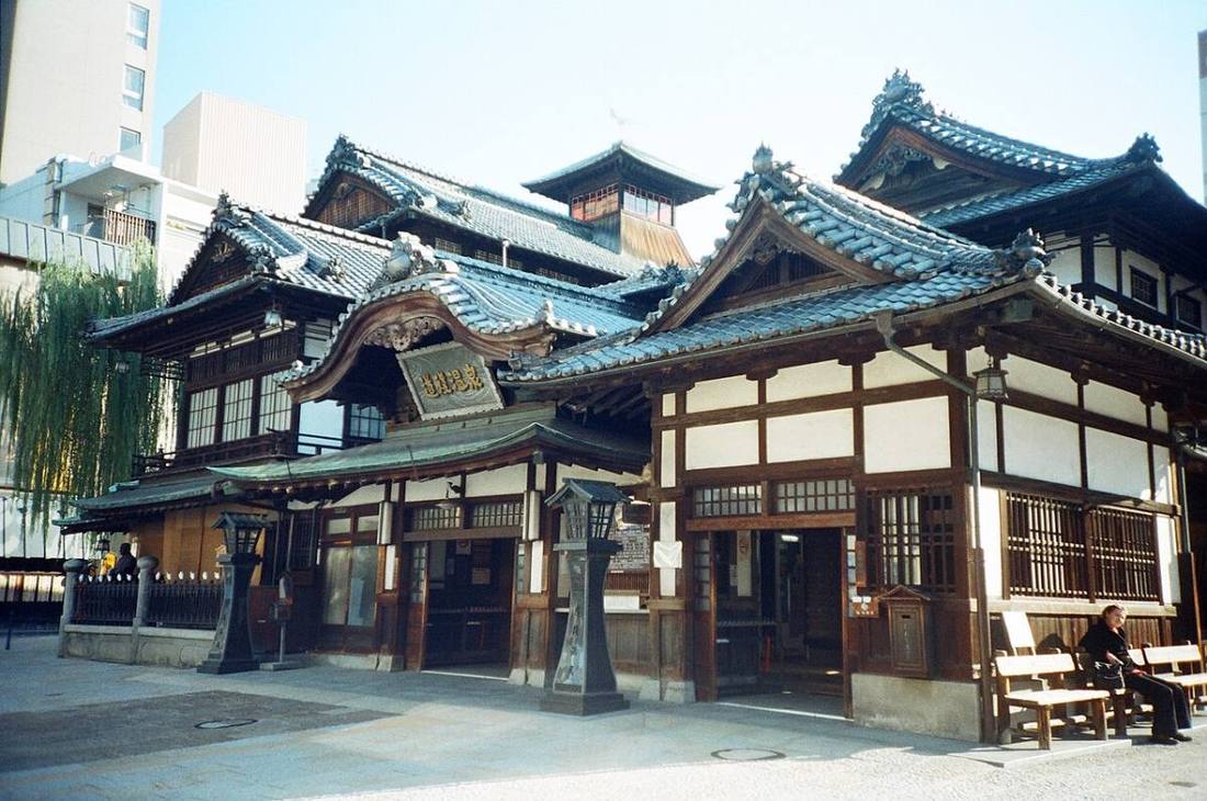
Photo: Arnaud Malon / CC BY 2.0 · Wikimedia Commons
Ehime Prefecture
Shikoku region · Prefecture
Official website
Ehime Prefecture has the largest population in Shikoku. It grows many kinds of citrus, mainly unshu mandarin oranges, its farming of red sea bream ranks 1st in Japan, and Imabari towels are known throughout Japan. With Dogo Onsen (hot spring) and its role as the setting of the novel "Botchan," the prefecture also has a literary atmosphere.
- Mandarin oranges and other citrus
- Dogo Onsen
- Imabari towels
- Shimanami Kaido
Key facts
- Municipalities
- 20 (11 cities, 9 towns)
Source: Statistics Bureau of Japan, 2025 Population Census (population, area and density); area from the Geospatial Information Authority of Japan (GSI), Area Statistics of Prefectures and Municipalities (2025). National ranks are among the 47 prefectures, ordered by this site from these values.
Places to know
- Matsuyama City Dogo Onsen, one of the oldest hot springs in Japan, and Matsuyama Castle.
- Imabari City A city of towels and shipbuilding, on the Shikoku side of the Shimanami Kaido.
- Uchiko Town A white-walled townscape that prospered from Japanese wax (mokuro), and the Uchiko-za theater.
Current warnings, advisories and earthquakes
Places to visit in Ehime Prefecture
 Castle · Matsuyama CityMatsuyama Castlecastle in Iyo province (now Matsuyama, Ehime prefecture), Japan
 Castle · Uwajima CityUwajima Castlebuilding in Uwajima, Ehime Prefecture, Japan
 Castle · Imabari CityImabari CastleJapanese castle in Imabari, Ehime, Japan, which is well known as one of the three Mizujiro, or "Castles on the sea", in Japan
 Island · Imabari CityOmishimaisland in Ehime, Japan
 Island · Ozu City, EhimeAoshimaisland in Ehime Prefecture, Japan
 Shinto shrine · Imabari CityOyamazumi ShrineShinto shrine in Ōmishima Island, Imabari, Ehime prefecture, Japan
 Hot spring (onsen) · Matsuyama CityDogo Onsenhot spring in the city of Matsuyama, Ehime Prefecture on the island of Shikoku, Japan
 Castle · Ozu City, EhimeOzu Castlebuilding in Ozu, Ehime Prefecture, Japan
 Buddhist temple · Matsuyama CityIshite-ji TempleShingon temple in Matsuyama, Ehime Prefecture, Japan, which is Temple 51 on the Shikoku 88 temple pilgrimage
- Bridge · Imabari CityKurushima-Kaikyo BridgeBridge complex in Japan connecting the island of Ōshima to the main part of Shikoku
Browse by category
Shrines, temples, castles and historic sites
Chosen automatically, most popular first, from landmarks and cultural properties registered in Wikidata (we have not checked whether each is open). Names and descriptions: Wikidata (CC0); photos: Wikimedia Commons (photographer and license under each photo).
National parks in Ehime Prefecture
Chosen by overlaying the park boundaries (Ministry of the Environment, Biodiversity Center of Japan, "National Park Areas" GIS data, updated April 28, 2025, combined and simplified by NIPPON ATLAS) with municipal boundaries (National Land Numerical Information, January 2021), keeping overlaps of about 0.5 km² or more (approximate). Areas are the land areas from the Ministry of the Environment, "Overview of National Parks" (April 10, 2026). All national parks
Municipalities in Ehime Prefecture (20)
| Municipality | Population | 5-year change | Area | Temperature nownearest AMeDAS |
|---|
| Matsuyama City | 497,067 | −2.8% | 429 km² | |
| Imabari City | 141,567 | −6.7% | 419 km² | |
| Uwajima City | 62,744 | −11.4% | 468 km² | |
| Yawatahama City | 28,475 | −11.0% | 133 km² | |
| Niihama City | 108,648 | −6.3% | 234 km² | |
| Saijo City | 98,596 | −5.9% | 510 km² | |
| Ozu City | 37,328 | −8.0% | 432 km² | |
| Iyo City | 33,415 | −4.9% | 194 km² | |
| Shikokuchuo City | 77,107 | −6.8% | 421 km² | |
| Seiyo City | 31,628 | −10.6% | 514 km² | |
| Toon City | 32,757 | −3.4% | 211 km² | |
| Kamijima Town | 5,804 | −10.8% | 30.38 km² | |
| Kumakogen Town | 6,290 | −15.0% | 584 km² | |
| Masaki Town | 29,003 | −2.1% | 20.38 km² | |
| Tobe Town | 19,623 | −4.2% | 102 km² | |
| Uchiko Town | 13,733 | −10.4% | 299 km² | |
| Ikata Town | 7,077 | −15.7% | 93.83 km² | |
| Matsuno Town | 3,308 | −10.0% | 98.45 km² | |
| Kihoku Town | 8,666 | −10.5% | 242 km² | |
| Ainan Town | 17,071 | −12.9% | 239 km² | |
Source: Statistics Bureau of Japan, 2025 Population Census (population in 2025; change compared with 2020). Area: GSI (2025). Designated cities are shown as one city (wards combined). "Temperature now" is the latest JMA AMeDAS observation (preliminary) at the nearest station in the same prefecture, loaded and shown unchanged when you open the page.