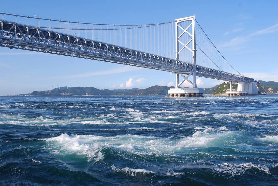
Photo: katorisi / CC BY-SA 3.0 · Wikimedia Commons
Tokushima Prefecture
Shikoku region · Prefecture
Official website
Tokushima Prefecture is known for the Awa Odori dance, which has a history of 400 years. The prefecture is rich in nature and tradition, with the Naruto whirlpools, the vine bridge of Iya in a remote mountain area and Awa indigo for indigo dyeing. It is a major producer of sudachi (a small green citrus).
- Awa Odori
- Naruto whirlpools
- Sudachi
- Awa indigo
Key facts
- Municipalities
- 24 (8 cities, 15 towns, 1 village)
Source: Statistics Bureau of Japan, 2025 Population Census (population, area and density); area from the Geospatial Information Authority of Japan (GSI), Area Statistics of Prefectures and Municipalities (2025). National ranks are among the 47 prefectures, ordered by this site from these values.
Places to know
- Tokushima City Many people from all over Japan visit for the Awa Odori in summer.
- Naruto City The whirlpools and the Otsuka Museum of Art.
- Kamikatsu Town A "leaf business" that sells leaves to garnish dishes, and a Zero Waste Declaration.
Current warnings, advisories and earthquakes
Places to visit in Tokushima Prefecture
Browse by category
Shrines, temples, castles and historic sites
Chosen automatically, most popular first, from landmarks and cultural properties registered in Wikidata (we have not checked whether each is open). Names and descriptions: Wikidata (CC0); photos: Wikimedia Commons (photographer and license under each photo).
National parks in Tokushima Prefecture
- Setonaikai National ParkTotal park area 673 km²Also in Hyogo, Wakayama, Okayama, Hiroshima, Yamaguchi, Kagawa, Ehime, Oita
Chosen by overlaying the park boundaries (Ministry of the Environment, Biodiversity Center of Japan, "National Park Areas" GIS data, updated April 28, 2025, combined and simplified by NIPPON ATLAS) with municipal boundaries (National Land Numerical Information, January 2021), keeping overlaps of about 0.5 km² or more (approximate). Areas are the land areas from the Ministry of the Environment, "Overview of National Parks" (April 10, 2026). All national parks
Municipalities in Tokushima Prefecture (24)
| Municipality | Population | 5-year change | Area | Temperature nownearest AMeDAS |
|---|
| Tokushima City | 240,957 | −4.5% | 192 km² | |
| Naruto City | 51,000 | −6.6% | 136 km² | |
| Komatsushima City | 33,896 | −6.2% | 45.37 km² | |
| Anan City | 64,549 | −7.1% | 279 km² | |
| Yoshinogawa City | 35,507 | −8.4% | 144 km² | |
| Awa City | 31,527 | −9.2% | 191 km² | |
| Mima City | 25,466 | −9.2% | 367 km² | |
| Miyoshi City | 20,526 | −13.0% | 721 km² | |
| Katsuura Town | 4,251 | −12.1% | 69.83 km² | |
| Kamikatsu Town | 1,191 | −13.7% | 110 km² | |
| Sanagochi Village | 1,863 | −9.5% | 42.28 km² | |
| Ishii Town | 23,620 | −4.9% | 28.85 km² | |
| Kamiyama Town | 4,171 | −10.2% | 173 km² | |
| Naka Town | 6,273 | −14.9% | 695 km² | |
| Mugi Town | 3,125 | −16.5% | 56.62 km² | |
| Minami Town | 5,425 | −12.8% | 141 km² | |
| Kaiyo Town | 7,387 | −11.6% | 328 km² | |
| Matsushige Town | 14,079 | −3.5% | 14.34 km² | |
| Kitajima Town | 22,895 | +0.7% | 8.74 km² | |
| Aizumi Town | 34,942 | −0.9% | 16.27 km² | |
| Itano Town | 12,376 | −5.1% | 36.22 km² | |
| Kamiita Town | 10,511 | −7.7% | 34.58 km² | |
| Tsurugi Town | 6,547 | −15.1% | 195 km² | |
| Higashimiyoshi Town | 12,706 | −6.7% | 122 km² | |
Source: Statistics Bureau of Japan, 2025 Population Census (population in 2025; change compared with 2020). Area: GSI (2025). Designated cities are shown as one city (wards combined). "Temperature now" is the latest JMA AMeDAS observation (preliminary) at the nearest station in the same prefecture, loaded and shown unchanged when you open the page.