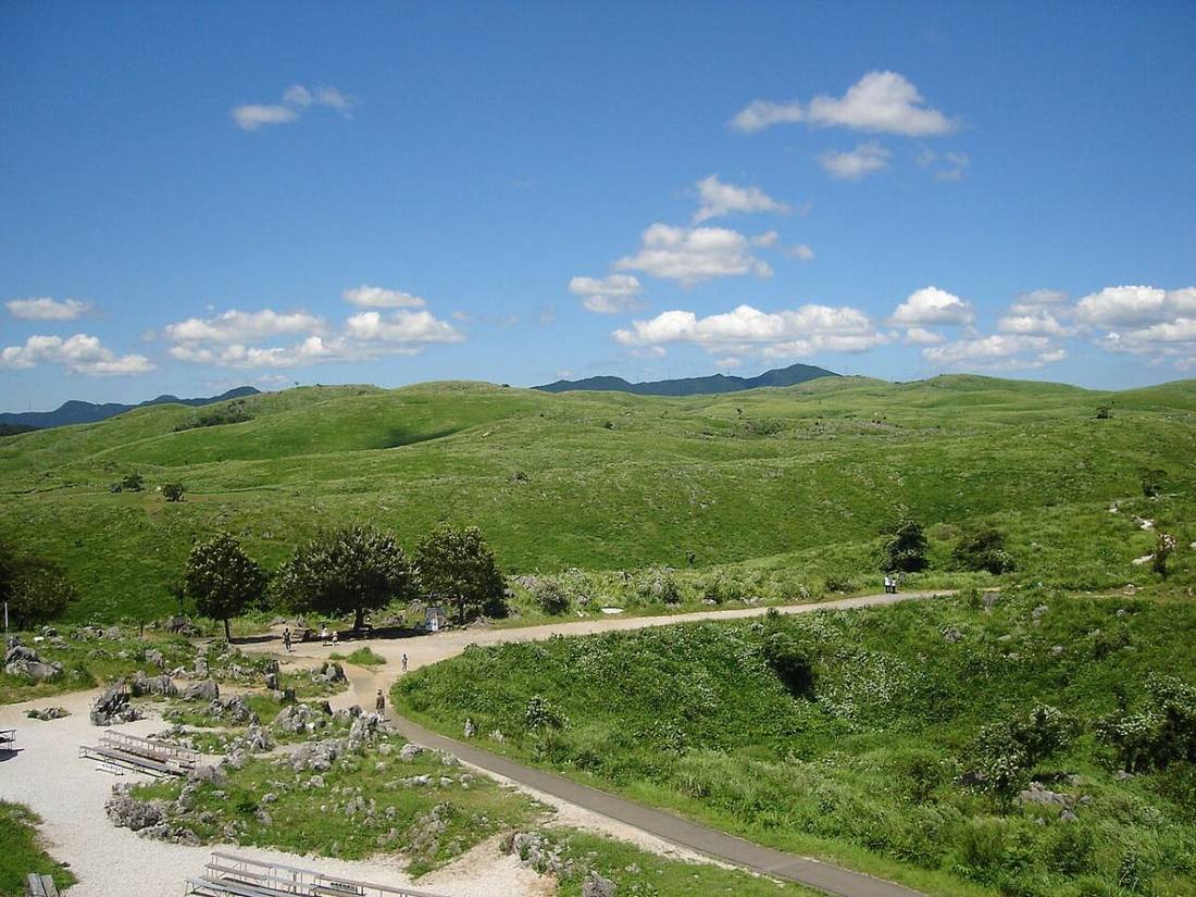
Photo: 日本語版ウィキペディアの池田賢一郎さん / CC BY-SA 3.0 · Wikimedia Commons
Yamaguchi Prefecture
Chugoku region · Prefecture
Official website
Yamaguchi Prefecture is at the western end of Honshu and is surrounded by the sea on three sides. It was the land of the Choshu Domain, which drove the Meiji Restoration, and many activists of that time came from Hagi. The prefecture has many sights, such as fugu (pufferfish) in Shimonoseki, the Kintai Bridge and the karst plateau of Akiyoshidai.
- Meiji Restoration
- Fugu (pufferfish)
- Akiyoshidai and Akiyoshido Cave
- Motonosumi Shrine
Key facts
- Municipalities
- 19 (13 cities, 6 towns)
Source: Statistics Bureau of Japan, 2025 Population Census (population, area and density); area from the Geospatial Information Authority of Japan (GSI), Area Statistics of Prefectures and Municipalities (2025). National ranks are among the 47 prefectures, ordered by this site from these values.
Places to know
- Shimonoseki City A port city on the Kanmon Straits, known as the home of fugu.
- Hagi City The Shoka Sonjuku school and the castle town. Hagi also has component parts of the Sites of Japan's Meiji Industrial Revolution.
- Iwakuni City The Kintai Bridge, with its 5 beautiful arches.
Current warnings, advisories and earthquakes
Places to visit in Yamaguchi Prefecture
Browse by category
Shrines, temples, castles and historic sites
Chosen automatically, most popular first, from landmarks and cultural properties registered in Wikidata (we have not checked whether each is open). Names and descriptions: Wikidata (CC0); photos: Wikimedia Commons (photographer and license under each photo).
National parks in Yamaguchi Prefecture
- Setonaikai National ParkTotal park area 673 km²Also in Hyogo, Wakayama, Okayama, Hiroshima, Tokushima, Kagawa, Ehime, Oita
Chosen by overlaying the park boundaries (Ministry of the Environment, Biodiversity Center of Japan, "National Park Areas" GIS data, updated April 28, 2025, combined and simplified by NIPPON ATLAS) with municipal boundaries (National Land Numerical Information, January 2021), keeping overlaps of about 0.5 km² or more (approximate). Areas are the land areas from the Ministry of the Environment, "Overview of National Parks" (April 10, 2026). All national parks
Municipalities in Yamaguchi Prefecture (19)
| Municipality | Population | 5-year change | Area | Temperature nownearest AMeDAS |
|---|
| Shimonoseki City | 237,611 | −6.8% | 716 km² | |
| Ube City | 152,689 | −6.1% | 287 km² | |
| Yamaguchi City | 190,271 | −1.9% | 1,023 km² | |
| Hagi City | 39,745 | −10.9% | 699 km² | |
| Hofu City | 109,596 | −3.8% | 189 km² | |
| Kudamatsu City | 54,991 | −1.6% | 89.34 km² | |
| Iwakuni City | 119,466 | −7.5% | 874 km² | |
| Hikari City | 46,292 | −7.0% | 92.13 km² | |
| Nagato City | 28,791 | −11.5% | 357 km² | |
| Yanai City | 28,512 | −7.4% | 140 km² | |
| Mine City | 20,133 | −13.4% | 473 km² | |
| Shunan City | 131,125 | −4.7% | 656 km² | |
| San'yo-Onoda City | 56,530 | −6.3% | 133 km² | |
| Suo-oshima Town | 12,838 | −13.2% | 138 km² | |
| Waki Town | 5,433 | −10.0% | 10.58 km² | |
| Kaminoseki Town | 1,889 | −19.3% | 34.69 km² | |
| Tabuse Town | 13,380 | −7.6% | 50.42 km² | |
| Hirao Town | 10,777 | −9.5% | 34.54 km² | |
| Abu Town | 2,701 | −11.6% | 116 km² | |
Source: Statistics Bureau of Japan, 2025 Population Census (population in 2025; change compared with 2020). Area: GSI (2025). Designated cities are shown as one city (wards combined). "Temperature now" is the latest JMA AMeDAS observation (preliminary) at the nearest station in the same prefecture, loaded and shown unchanged when you open the page.