Photo: Fjkelfeimvvn / CC BY 3.0 · Wikimedia Commons
Okayama Prefecture
Chugoku region · Prefecture
Official website
Okayama Prefecture has few rainy days and is called the "Land of Sunshine." It is known as a fruit kingdom for white peaches, Muscat grapes and Pione grapes. It is the land of the Momotaro (Peach Boy) legend, and manufacturing is also active, including Kojima, the birthplace of Japanese-made jeans, and Bizen ware pottery.
- Land of Sunshine
- White peaches and Muscat grapes
- Momotaro (Peach Boy)
- Denim (Kojima)
Key facts
- Municipalities
- 27 (15 cities, 10 towns, 2 villages)
Source: Statistics Bureau of Japan, 2025 Population Census (population, area and density); area from the Geospatial Information Authority of Japan (GSI), Area Statistics of Prefectures and Municipalities (2025). National ranks are among the 47 prefectures, ordered by this site from these values.
Places to know
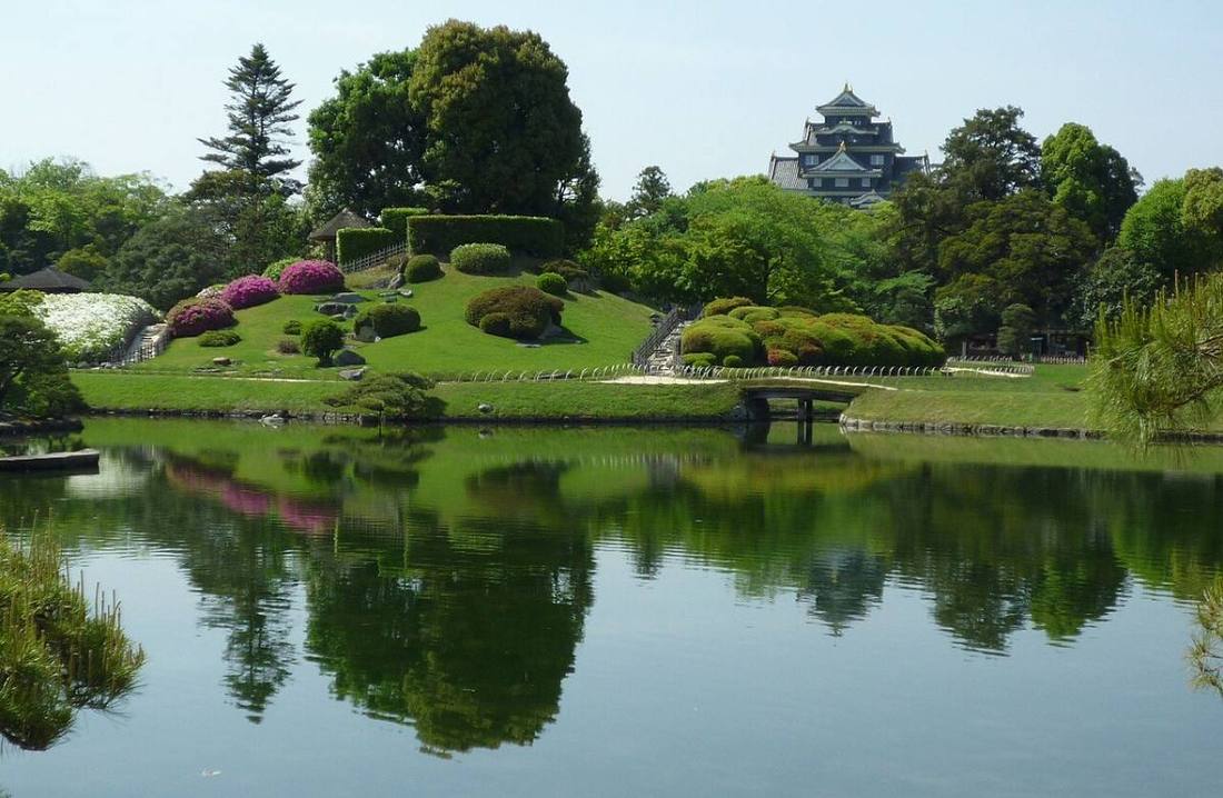
- Okayama City Koraku-en, one of the Three Great Gardens of Japan, and Okayama Castle, known as "Crow Castle."
- Kurashiki City The white-walled Bikan Historical Quarter and the Kojima Jeans Street.
- Bizen City The home of Bizen ware, one of the Six Ancient Kilns of Japan.
Current warnings, advisories and earthquakes
Places to visit in Okayama Prefecture
Browse by category
Shrines, temples, castles and historic sites
Chosen automatically, most popular first, from landmarks and cultural properties registered in Wikidata (we have not checked whether each is open). Names and descriptions: Wikidata (CC0); photos: Wikimedia Commons (photographer and license under each photo).
National parks in Okayama Prefecture
Chosen by overlaying the park boundaries (Ministry of the Environment, Biodiversity Center of Japan, "National Park Areas" GIS data, updated April 28, 2025, combined and simplified by NIPPON ATLAS) with municipal boundaries (National Land Numerical Information, January 2021), keeping overlaps of about 0.5 km² or more (approximate). Areas are the land areas from the Ministry of the Environment, "Overview of National Parks" (April 10, 2026). All national parks
Municipalities in Okayama Prefecture (27)
| Municipality | Population | 5-year change | Area | Temperature nownearest AMeDAS |
|---|
| Okayama City | 707,387 | −2.4% | 790 km² | |
| Kurashiki City | 461,848 | −2.7% | 356 km² | |
| Tsuyama City | 92,543 | −7.4% | 506 km² | |
| Tamano City | 51,910 | −8.2% | 103 km² | |
| Kasaoka City | 41,221 | −10.6% | 136 km² | |
| Ibara City | 35,310 | −8.0% | 244 km² | |
| Soja City | 68,731 | −0.4% | 212 km² | |
| Takahashi City | 25,546 | −12.1% | 547 km² | |
| Niimi City | 24,861 | −11.5% | 793 km² | |
| Bizen City | 28,640 | −11.4% | 258 km² | |
| Setouchi City | 34,654 | −3.9% | 125 km² | |
| Akaiwa City | 40,892 | −4.1% | 209 km² | |
| Maniwa City | 38,441 | −10.0% | 829 km² | |
| Mimasaka City | 23,106 | −10.9% | 429 km² | |
| Asakuchi City | 30,366 | −7.3% | 66.46 km² | |
| Wake Town | 12,334 | −9.5% | 144 km² | |
| Hayashima Town | 12,570 | +1.6% | 7.62 km² | |
| Satosho Town | 10,424 | −4.8% | 12.23 km² | |
| Yakage Town | 12,341 | −8.0% | 90.62 km² | |
| Shinjo Village | 714 | −12.2% | 67.11 km² | |
| Kagamino Town | 11,121 | −7.8% | 420 km² | |
| Shoo Town | 10,358 | −4.9% | 54.05 km² | |
| Nagi Town | 5,088 | −8.8% | 69.52 km² | |
| Nishiawakura Village | 1,244 | −11.0% | 57.97 km² | |
| Kumenan Town | 4,041 | −10.8% | 78.65 km² | |
| Misaki Town | 11,573 | −11.3% | 232 km² | |
| Kibi-chuo Town | 9,896 | −9.1% | 269 km² | |
Source: Statistics Bureau of Japan, 2025 Population Census (population in 2025; change compared with 2020). Area: GSI (2025). Designated cities are shown as one city (wards combined). "Temperature now" is the latest JMA AMeDAS observation (preliminary) at the nearest station in the same prefecture, loaded and shown unchanged when you open the page.