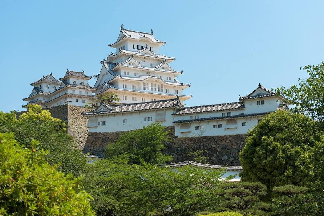
Photo: Nikos Kitsakis / CC BY-SA 4.0 · Wikimedia Commons
Hyogo Prefecture
Kansai (Kinki) region · Prefecture
Official website
A varied prefecture facing both the Sea of Japan and the Seto Inland Sea, made up of five old provinces (Settsu, Harima, Tajima, Tanba and Awaji). Its attractions are endless: the international port of Kobe, Himeji Castle, a National Treasure, the hot springs of Arima and Kinosaki, Nada sake and Kobe beef.
- Himeji Castle (World Cultural Heritage)
- Port of Kobe
- Nada sake
- Kinosaki and Arima hot springs
Key facts
- Municipalities
- 41 (29 cities, 12 towns)
Source: Statistics Bureau of Japan, 2025 Population Census (population, area and density); area from the Geospatial Information Authority of Japan (GSI), Area Statistics of Prefectures and Municipalities (2025). National ranks are among the 47 prefectures, ordered by this site from these values.
Places to know
- Kobe City The exotic atmosphere and night views of a port city, and Arima Onsen.
- Himeji City Himeji Castle, a National Treasure also called the White Heron Castle.
- Toyooka City Kinosaki Onsen and the home of the Oriental white stork.
Current warnings, advisories and earthquakes
Places to visit in Hyogo Prefecture
Browse by category
Shrines, temples, castles and historic sites
Chosen automatically, most popular first, from landmarks and cultural properties registered in Wikidata (we have not checked whether each is open). Names and descriptions: Wikidata (CC0); photos: Wikimedia Commons (photographer and license under each photo).
National parks in Hyogo Prefecture
Chosen by overlaying the park boundaries (Ministry of the Environment, Biodiversity Center of Japan, "National Park Areas" GIS data, updated April 28, 2025, combined and simplified by NIPPON ATLAS) with municipal boundaries (National Land Numerical Information, January 2021), keeping overlaps of about 0.5 km² or more (approximate). Areas are the land areas from the Ministry of the Environment, "Overview of National Parks" (April 10, 2026). All national parks
Municipalities in Hyogo Prefecture (41)
| Municipality | Population | 5-year change | Area | Temperature nownearest AMeDAS |
|---|
| Kobe City | 1,494,997 | −2.0% | 557 km² | |
| Himeji City | 517,867 | −2.4% | 535 km² | |
| Amagasaki City | 457,195 | −0.5% | 50.70 km² | |
| Akashi City | 306,587 | +1.0% | 49.41 km² | |
| Nishinomiya City | 482,260 | −0.7% | 99.95 km² | |
| Sumoto City | 38,556 | −6.5% | 182 km² | |
| Ashiya City | 91,552 | −2.5% | 18.47 km² | |
| Itami City | 195,049 | −1.6% | 25.00 km² | |
| Aioi City | 26,007 | −8.3% | 90.40 km² | |
| Toyooka City | 71,798 | −7.3% | 698 km² | |
| Kakogawa City | 253,036 | −3.0% | 138 km² | |
| Ako City | 42,701 | −7.0% | 127 km² | |
| Nishiwaki City | 35,729 | −7.6% | 132 km² | |
| Takarazuka City | 217,157 | −4.1% | 102 km² | |
| Miki City | 70,961 | −5.8% | 177 km² | |
| Takasago City | 83,322 | −5.0% | 34.38 km² | |
| Kawanishi City | 149,531 | −1.8% | 53.44 km² | |
| Ono City | 46,138 | −3.0% | 92.94 km² | |
| Sanda City | 105,016 | −3.9% | 210 km² | |
| Kasai City | 40,211 | −5.8% | 151 km² | |
| Tamba-Sasayama City | 36,990 | −6.6% | 378 km² | |
| Yabu City | 19,740 | −10.8% | 423 km² | |
| Tamba City | 57,506 | −6.5% | 493 km² | |
| Minami-Awaji City | 41,037 | −7.0% | 229 km² | |
| Asago City | 26,483 | −8.6% | 403 km² | |
| Awaji City | 39,382 | −6.2% | 184 km² | |
| Shiso City | 31,250 | −10.3% | 659 km² | |
| Kato City | 39,471 | −2.9% | 158 km² | |
| Tatsuno City | 69,623 | −6.3% | 211 km² | |
| Inagawa Town | 27,411 | −7.6% | 90.33 km² | |
| Taka Town | 17,333 | −10.0% | 185 km² | |
| Inami Town | 29,366 | −3.0% | 34.92 km² | |
| Harima Town | 33,239 | −1.1% | 9.13 km² | |
| Ichikawa Town | 9,911 | −11.8% | 82.67 km² | |
| Fukusaki Town | 18,310 | −5.5% | 45.79 km² | |
| Kamikawa Town | 9,477 | −10.7% | 202 km² | |
| Taishi Town | 32,591 | −2.6% | 22.61 km² | |
| Kamigori Town | 12,808 | −7.7% | 150 km² | |
| Sayo Town | 14,122 | −11.0% | 307 km² | |
| Kami Town | 14,031 | −12.7% | 369 km² | |
| Shin'onsen Town | 12,041 | −9.6% | 241 km² | |
Source: Statistics Bureau of Japan, 2025 Population Census (population in 2025; change compared with 2020). Area: GSI (2025). Designated cities are shown as one city (wards combined). "Temperature now" is the latest JMA AMeDAS observation (preliminary) at the nearest station in the same prefecture, loaded and shown unchanged when you open the page.