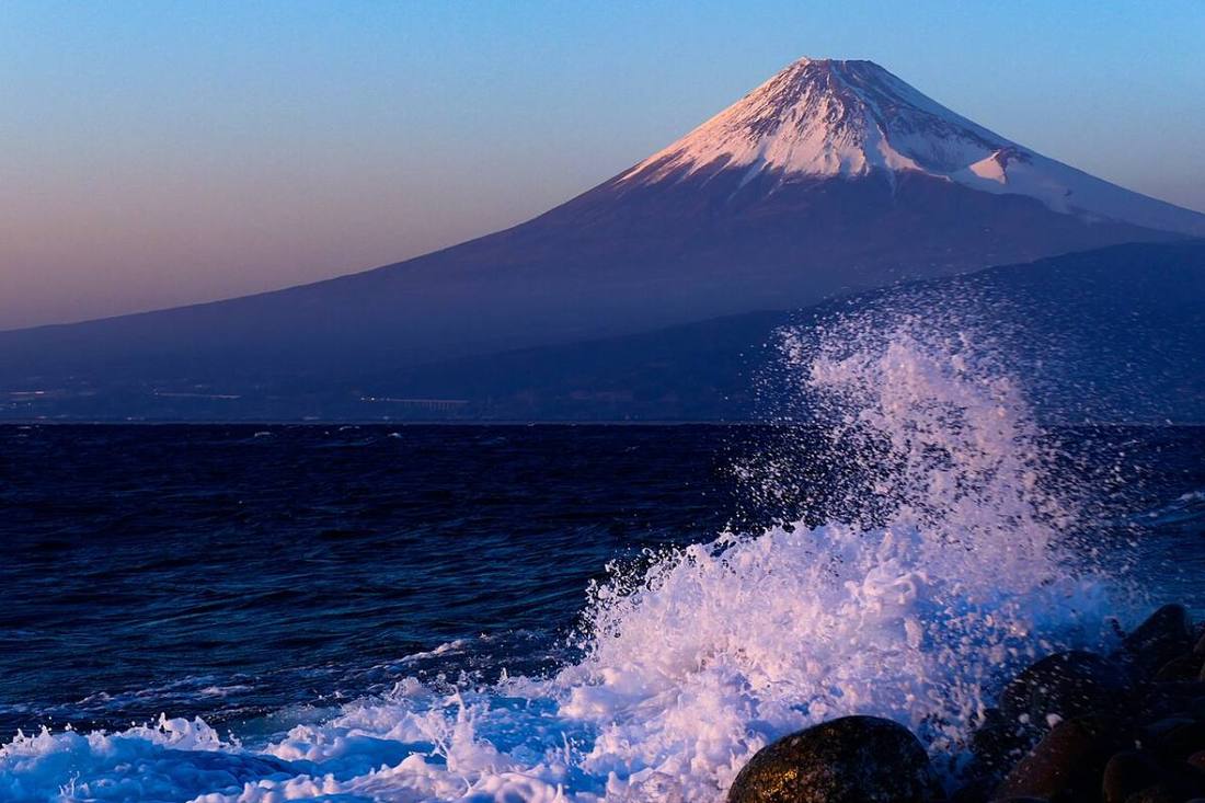
Photo: MaedaAkihiko / CC BY-SA 4.0 · Wikimedia Commons
Shizuoka Prefecture
Chubu region · Prefecture
Official website
A long east-west prefecture embracing Mt. Fuji and Suruga Bay. It is famous for tea, and tuna and bonito landings and manufacturing such as pianos and motorcycles are also active. The hot spring towns of the Izu Peninsula are the Tokyo area's nearby retreat.
- Mt. Fuji
- Shizuoka tea
- Izu hot springs
- Hamamatsu musical instruments and motorcycles
Key facts
- Municipalities
- 35 (23 cities, 12 towns)
Source: Statistics Bureau of Japan, 2025 Population Census (population, area and density); area from the Geospatial Information Authority of Japan (GSI), Area Statistics of Prefectures and Municipalities (2025). National ranks are among the 47 prefectures, ordered by this site from these values.
Places to know
- Shizuoka City Sunpu Castle, Nihondaira and Shimizu Port.
- Hamamatsu City A manufacturing city of musical instruments and motorcycles. Eel from Lake Hamana.
- Atami City A major historic hot spring resort close to the Tokyo area.
Current warnings, advisories and earthquakes
Places to visit in Shizuoka Prefecture
 World Heritage Site · Fujinomiya CityMt. Fujivolcano in Yamanashi and Shizuoka Prefectures, Japan
 Shinto shrine · Fujinomiya CityFujisan Hongu Sengen TaishaShinto shrine in Shizuoka Prefecture, Japan
 Waterfall · Fujinomiya CityShiraito Fallswaterfall in Fujinomiya, Shizuoka Prefecture, near Mount Fuji, Japan
 Lake · Hamamatsu CityLake Hamanalake in Shizuoka Prefecture, Chūbu region, Japan
 Shinto shrine · Shizuoka CityKunozan Tosho-guShinto shrine in Shizuoka Prefecture, Japan
 Coast · Shizuoka CityMiho no MatsubaraJapanese park
 Castle · Shizuoka CitySunpu CastleJapanese castle located in Shizuoka
 Shinto shrine · Fujinomiya CityFujisan, sacred place and source of artistic inspirationWorld Heritage site in Japan
 World Heritage Site · Izunokuni CityNirayama Reverberatory FurnacesUNESCO World Heritage Site in Shizuoka, Japan
 Special historic site · Shizuoka CityToroarchaeological site in Shizuoka Prefecture, Japan
Browse by category
Shrines, temples, castles and historic sites
Chosen automatically, most popular first, from landmarks and cultural properties registered in Wikidata (we have not checked whether each is open). Names and descriptions: Wikidata (CC0); photos: Wikimedia Commons (photographer and license under each photo).
National parks in Shizuoka Prefecture
Chosen by overlaying the park boundaries (Ministry of the Environment, Biodiversity Center of Japan, "National Park Areas" GIS data, updated April 28, 2025, combined and simplified by NIPPON ATLAS) with municipal boundaries (National Land Numerical Information, January 2021), keeping overlaps of about 0.5 km² or more (approximate). Areas are the land areas from the Ministry of the Environment, "Overview of National Parks" (April 10, 2026). All national parks
Municipalities in Shizuoka Prefecture (35)
| Municipality | Population | 5-year change | Area | Temperature nownearest AMeDAS |
|---|
| Shizuoka City | 658,781 | −5.0% | 1,412 km² | |
| Hamamatsu City | 765,254 | −3.2% | 1,558 km² | |
| Numazu City | 179,139 | −5.4% | 187 km² | |
| Atami City | 31,330 | −8.4% | 61.70 km² | |
| Mishima City | 103,044 | −4.4% | 62.02 km² | |
| Fujinomiya City | 119,089 | −7.0% | 389 km² | |
| Ito City | 61,183 | −6.6% | 124 km² | |
| Shimada City | 91,161 | −4.8% | 316 km² | |
| Fuji City | 237,650 | −3.2% | 245 km² | |
| Iwata City | 160,456 | −3.7% | 163 km² | |
| Yaizu City | 130,848 | −4.4% | 70.30 km² | |
| Kakegawa City | 111,544 | −3.0% | 266 km² | |
| Fujieda City | 134,425 | −4.9% | 194 km² | |
| Gotemba City | 80,965 | −6.5% | 195 km² | |
| Fukuroi City | 86,503 | −1.5% | 108 km² | |
| Shimoda City | 17,906 | −11.3% | 104 km² | |
| Susono City | 47,314 | −7.1% | 138 km² | |
| Kosai City | 55,167 | −4.7% | 86.56 km² | |
| Izu City | 25,708 | −8.8% | 364 km² | |
| Omaezaki City | 28,442 | −8.6% | 65.57 km² | |
| Kikugawa City | 45,478 | −4.8% | 94.19 km² | |
| Izunokuni City | 44,124 | −5.7% | 94.62 km² | |
| Makinohara City | 40,303 | −7.4% | 112 km² | |
| Higashiizu Town | 10,217 | −11.1% | 77.82 km² | |
| Kawazu Town | 6,129 | −10.8% | 101 km² | |
| Minamiizu Town | 6,997 | −11.2% | 110 km² | |
| Matsuzaki Town | 5,230 | −13.4% | 85.11 km² | |
| Nishiizu Town | 6,085 | −14.2% | 105 km² | |
| Kannami Town | 34,757 | −5.5% | 65.16 km² | |
| Shimizu Town | 31,080 | −2.0% | 8.81 km² | |
| Nagaizumi Town | 43,245 | −0.2% | 26.63 km² | |
| Oyama Town | 17,100 | −7.9% | 136 km² | |
| Yoshida Town | 27,735 | −4.1% | 20.73 km² | |
| Kawanehon Town | 5,334 | −14.1% | 497 km² | |
| Mori Town | 15,944 | −8.7% | 134 km² | |
Source: Statistics Bureau of Japan, 2025 Population Census (population in 2025; change compared with 2020). Area: GSI (2025). Designated cities are shown as one city (wards combined). "Temperature now" is the latest JMA AMeDAS observation (preliminary) at the nearest station in the same prefecture, loaded and shown unchanged when you open the page.