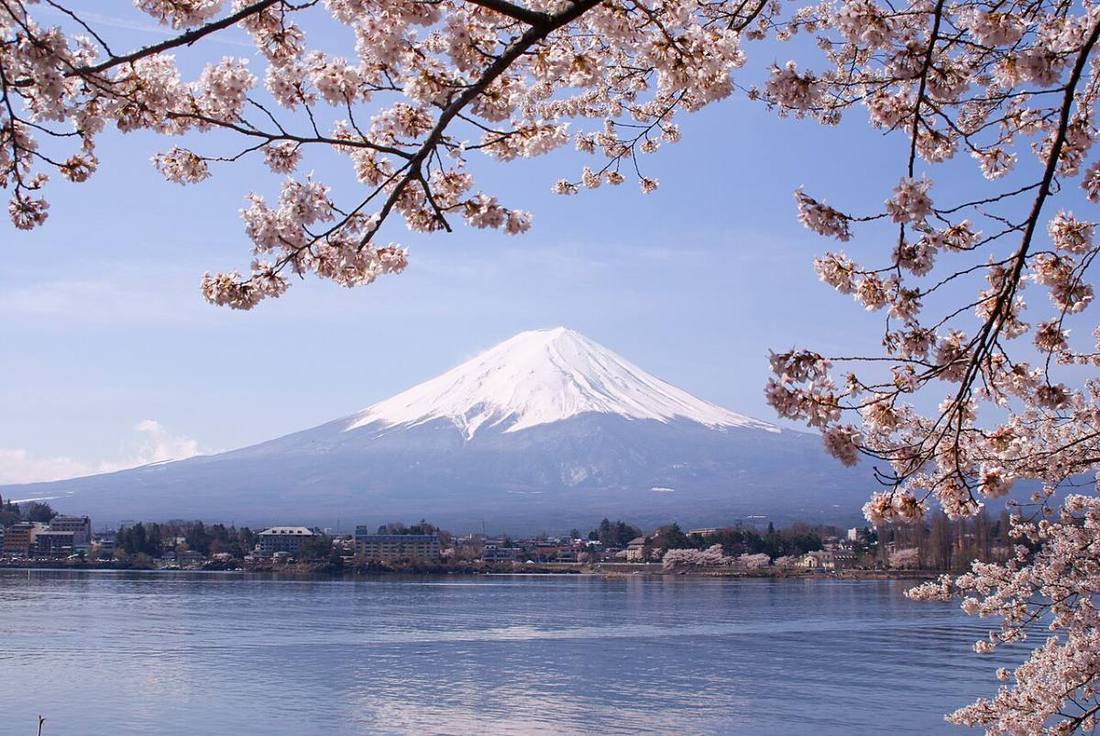
Photo: Midori / CC BY 3.0 · Wikimedia Commons
Yamanashi Prefecture
Chubu region · Prefecture
Official website
A basin prefecture surrounded by Mt. Fuji, the Southern Alps and Yatsugatake. It ranks 1st in Japan for grape and peach harvests and is also the birthplace of Japanese wine.
- Mt. Fuji (World Cultural Heritage)
- Grapes and peaches
- Wine
- Hoto noodles
Key facts
- Municipalities
- 27 (13 cities, 8 towns, 6 villages)
Source: Statistics Bureau of Japan, 2025 Population Census (population, area and density); area from the Geospatial Information Authority of Japan (GSI), Area Statistics of Prefectures and Municipalities (2025). National ranks are among the 47 prefectures, ordered by this site from these values.
Places to know
- Fujikawaguchiko Town Lake Kawaguchi, with its upside-down reflection of Mt. Fuji, and Fuji Five Lakes sightseeing.
- Koshu City The wineries of Katsunuma.
- Hokuto City Highlands and famous spring water at the southern foot of Yatsugatake.
Current warnings, advisories and earthquakes
Places to visit in Yamanashi Prefecture
 World Heritage Site · Fujikawaguchiko TownAokigaharaforest near Mount Fuji in Yamanashi Prefecture, Japan
- World Heritage Site · Yamanakako VillageFuji Five Lakesgroup of lakes
 Lake · Fujikawaguchiko TownLake Kawaguchilake in Yamanashi prefecture, Japan
 Lake · Yamanakako VillageLake Yamanakalake in Yamanakako, Chūbu region, Japan
 Lake · Fujikawaguchiko TownLake Motosulake in Fujikawaguchiko, Chūbu region, Japan
 Lake · Fujikawaguchiko TownLake Sailake in Fujikawaguchiko, Chūbu region, Japan
 World Heritage Site · Oshino VillageOshino Hakkaisprings in Oshino, Yamanashi, Japan
 Amusement park · Fujiyoshida CityFuji-Q Highlandamusement park
 Castle · Kofu City, YamanashiTsutsujigasaki CastleJapanese historical site
 Gorge · Kofu City, YamanashiShosenkyo
Browse by category
Shrines, temples, castles and historic sites
Chosen automatically, most popular first, from landmarks and cultural properties registered in Wikidata (we have not checked whether each is open). Names and descriptions: Wikidata (CC0); photos: Wikimedia Commons (photographer and license under each photo).
National parks in Yamanashi Prefecture
Chosen by overlaying the park boundaries (Ministry of the Environment, Biodiversity Center of Japan, "National Park Areas" GIS data, updated April 28, 2025, combined and simplified by NIPPON ATLAS) with municipal boundaries (National Land Numerical Information, January 2021), keeping overlaps of about 0.5 km² or more (approximate). Areas are the land areas from the Ministry of the Environment, "Overview of National Parks" (April 10, 2026). All national parks
Municipalities in Yamanashi Prefecture (27)
| Municipality | Population | 5-year change | Area | Temperature nownearest AMeDAS |
|---|
| Kofu City | 183,450 | −3.2% | 212 km² | |
| Fujiyoshida City | 43,633 | −6.2% | 122 km² | |
| Tsuru City | 30,262 | −2.4% | 162 km² | |
| Yamanashi City | 31,264 | −6.5% | 290 km² | |
| Otsuki City | 20,034 | −11.0% | 280 km² | |
| Nirasaki City | 27,745 | −4.5% | 144 km² | |
| Minami-Alps City | 69,196 | −0.4% | 264 km² | |
| Hokuto City | 41,767 | −5.2% | 602 km² | |
| Kai City | 75,507 | +0.3% | 71.95 km² | |
| Fuefuki City | 64,230 | −4.1% | 202 km² | |
| Uenohara City | 20,864 | −8.0% | 171 km² | |
| Koshu City | 26,955 | −7.8% | 264 km² | |
| Chuo City | 30,111 | −3.5% | 31.69 km² | |
| Ichikawamisato Town | 13,355 | −9.1% | 75.19 km² | |
| Hayakawa Town | 928 | −15.5% | 370 km² | |
| Minobu Town | 8,910 | −16.4% | 302 km² | |
| Nanbu Town | 6,326 | −11.6% | 201 km² | |
| Fujikawa Town | 13,181 | −7.3% | 112 km² | |
| Showa Town | 21,786 | +4.2% | 9.08 km² | |
| Doshi Village | 1,442 | −10.3% | 79.68 km² | |
| Nishikatsura Town | 3,606 | −10.8% | 15.22 km² | |
| Oshino Village | 9,150 | −0.9% | 25.05 km² | |
| Yamanakako Village | 5,214 | +0.7% | 53.05 km² | |
| Narusawa Village | 2,760 | −2.3% | 89.58 km² | |
| Fujikawaguchiko Town | 26,485 | +1.5% | 158 km² | |
| Kosuge Village | 603 | −11.8% | 52.78 km² | |
| Tabayama Village | 512 | −3.4% | 101 km² | |
Source: Statistics Bureau of Japan, 2025 Population Census (population in 2025; change compared with 2020). Area: GSI (2025). Designated cities are shown as one city (wards combined). "Temperature now" is the latest JMA AMeDAS observation (preliminary) at the nearest station in the same prefecture, loaded and shown unchanged when you open the page.