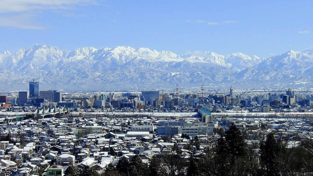
Photo: タチヤマカムイ / CC BY-SA 4.0 · Wikimedia Commons
Toyama Prefecture
Chubu region · Prefecture
Official website
A prefecture of great differences in height, from the 3,000 m-class Tateyama Range down to deep Toyama Bay. It is famous for the yellowtail, firefly squid and white shrimp of Toyama Bay, called a "natural fish tank," and for the tradition of the "Toyama medicine peddlers."
- Tateyama Kurobe Alpine Route
- Seafood of Toyama Bay
- Gokayama (World Cultural Heritage)
- Traditional medicine trade
Key facts
- Municipalities
- 15 (10 cities, 4 towns, 1 village)
Source: Statistics Bureau of Japan, 2025 Population Census (population, area and density); area from the Geospatial Information Authority of Japan (GSI), Area Statistics of Prefectures and Municipalities (2025). National ranks are among the 47 prefectures, ordered by this site from these values.
Places to know
- Tateyama Town A mountain route to the Yuki-no-Otani snow walls and Kurobe Dam.
- Nanto City The gassho-style (steep thatched-roof) villages of Gokayama.
- Himi City A fishing port known for landings of winter yellowtail (kanburi).
Current warnings, advisories and earthquakes
Places to visit in Toyama Prefecture
 Waterfall · Tateyama Town, ToyamaShomyo Fallswaterfall in Toyama Prefecture, Japan
 Castle · Toyama CityToyama Castlebuilding in Toyama Prefecture, Japan
 Gorge · Kurobe CityKurobe Gorgegorge in Japan
 Natural monument · Toyama CityMt. Yakushimountain in Toyama Prefecture, Japan
 Buddhist temple · Takaoka CityZuiryu-ji Templebuilding in Takaoka, Toyama Prefecture, Japan
 Castle · Takaoka CityTakaoka Castlecastle in Japan
 Place of scenic beauty · Takaoka CityAmaharashi Coast
 National Treasure · Takaoka CityGreat Buddha of TakaokaGreat Buddha statue in Takaoka, Toyama, Japan
 Hot spring (onsen) · Uozu CityTsubonokosen (Hot spring)onsen in Uozu, Japan
 Hot spring (onsen) · Kurobe CityUnazuki Onsenbuilding in Toyama Prefecture, Japan
Browse by category
Shrines, temples, castles and historic sites
Chosen automatically, most popular first, from landmarks and cultural properties registered in Wikidata (we have not checked whether each is open). Names and descriptions: Wikidata (CC0); photos: Wikimedia Commons (photographer and license under each photo).
National parks in Toyama Prefecture
Chosen by overlaying the park boundaries (Ministry of the Environment, Biodiversity Center of Japan, "National Park Areas" GIS data, updated April 28, 2025, combined and simplified by NIPPON ATLAS) with municipal boundaries (National Land Numerical Information, January 2021), keeping overlaps of about 0.5 km² or more (approximate). Areas are the land areas from the Ministry of the Environment, "Overview of National Parks" (April 10, 2026). All national parks
Municipalities in Toyama Prefecture (15)
| Municipality | Population | 5-year change | Area | Temperature nownearest AMeDAS |
|---|
| Toyama City | 399,197 | −3.6% | 1,242 km² | |
| Takaoka City | 158,431 | −4.8% | 210 km² | |
| Uozu City | 37,456 | −7.6% | 201 km² | |
| Himi City | 39,087 | −11.1% | 231 km² | |
| Namerikawa City | 31,317 | −3.2% | 54.62 km² | |
| Kurobe City | 37,599 | −5.1% | 426 km² | |
| Tonami City | 45,783 | −4.9% | 127 km² | |
| Oyabe City | 26,653 | −8.0% | 134 km² | |
| Nanto City | 43,916 | −8.4% | 669 km² | |
| Imizu City | 87,615 | −3.4% | 109 km² | |
| Funahashi Village | 3,274 | +4.5% | 3.47 km² | |
| Kamiichi Town | 17,697 | −8.5% | 237 km² | |
| Tateyama Town | 23,215 | −6.4% | 307 km² | |
| Nyuzen Town | 21,340 | −10.5% | 71.25 km² | |
| Asahi Town | 9,567 | −13.7% | 226 km² | |
Source: Statistics Bureau of Japan, 2025 Population Census (population in 2025; change compared with 2020). Area: GSI (2025). Designated cities are shown as one city (wards combined). "Temperature now" is the latest JMA AMeDAS observation (preliminary) at the nearest station in the same prefecture, loaded and shown unchanged when you open the page.