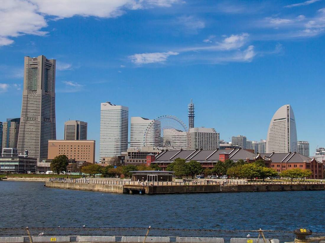
Photo: Japanbird / CC BY-SA 4.0 · Wikimedia Commons
Kanagawa Prefecture
Kanto region · Prefecture
Official website
Kanagawa ranks 2nd in Japan in population after Tokyo, and it is the only prefecture with 3 designated cities (Yokohama, Kawasaki and Sagamihara). Its sights are varied: Yokohama with its history as an open port, the old capital of Kamakura, the hot springs of Hakone and the Shonan coast.
- Port of Yokohama
- Kamakura, the old capital
- Hakone hot springs
- Shonan
Key facts
- Municipalities
- 33 (19 cities, 13 towns, 1 village)
Source: Statistics Bureau of Japan, 2025 Population Census (population, area and density); area from the Geospatial Information Authority of Japan (GSI), Area Statistics of Prefectures and Municipalities (2025). National ranks are among the 47 prefectures, ordered by this site from these values.
Places to know
- Yokohama City A population of about 3.75 million, the largest of any city in Japan.
- Kamakura City Tsurugaoka Hachimangu Shrine and the Great Buddha; an old capital of the samurai.
- Odawara City Odawara Castle and kamaboko (fish cakes); the gateway to Hakone.
Current warnings, advisories and earthquakes
Places to visit in Kanagawa Prefecture
 Buddhist temple · Kamakura CityKotoku-in TempleBuddhist temple in Kamakura, Kanagawa Prefecture, Japan
 Island · Fujisawa CityEnoshimaoffshore island in Fujisawa, Kanagawa prefecture, Japan
 Castle · Odawara CityOdawara Castlecastle in Kanagawa Prefecture, Japan
 Shinto shrine · Kamakura CityTsurugaoka HachimanguShinto shrine in Kanagawa Prefecture, Japan
 Museum · Yokosuka CityMikasa1900 pre-dreadnought battleship
 Buddhist temple · Kamakura CityEngaku-ji TempleZen Buddhist temple in Kamakura, Kanagawa prefecture, Japan
 Lake · Hakone TownLake Ashicrater lake
 Buddhist temple · Kamakura CityKencho-ji Templetemple in Kamakura, Kanagawa Prefecture, Japan
 Buddhist temple · Yokohama City, KanagawaSoji-ji TempleBuddhist temple in Yokohama, Japan
 Important Cultural Property · Yokohama City, KanagawaHikawa Maru1930 Hikawa Maru-class ocean liner
Browse by category
Shrines, temples, castles and historic sites
Chosen automatically, most popular first, from landmarks and cultural properties registered in Wikidata (we have not checked whether each is open). Names and descriptions: Wikidata (CC0); photos: Wikimedia Commons (photographer and license under each photo).
National parks in Kanagawa Prefecture
Chosen by overlaying the park boundaries (Ministry of the Environment, Biodiversity Center of Japan, "National Park Areas" GIS data, updated April 28, 2025, combined and simplified by NIPPON ATLAS) with municipal boundaries (National Land Numerical Information, January 2021), keeping overlaps of about 0.5 km² or more (approximate). Areas are the land areas from the Ministry of the Environment, "Overview of National Parks" (April 10, 2026). All national parks
Municipalities in Kanagawa Prefecture (33)
| Municipality | Population | 5-year change | Area | Temperature nownearest AMeDAS |
|---|
| Yokohama City | 3,750,952 | −0.7% | 438 km² | |
| Kawasaki City | 1,559,571 | +1.4% | 143 km² | |
| Sagamihara City | 718,908 | −0.9% | 329 km² | |
| Yokosuka City | 364,720 | −6.0% | 101 km² | |
| Hiratsuka City | 257,765 | −0.3% | 67.83 km² | |
| Kamakura City | 169,851 | −1.7% | 39.66 km² | |
| Fujisawa City | 443,726 | +1.6% | 69.56 km² | |
| Odawara City | 184,972 | −2.1% | 114 km² | |
| Chigasaki City | 244,680 | +0.9% | 35.70 km² | |
| Zushi City | 55,234 | −3.2% | 17.28 km² | |
| Miura City | 38,648 | −8.1% | 32.06 km² | |
| Hadano City | 161,829 | −0.4% | 104 km² | |
| Atsugi City | 222,785 | −0.4% | 93.83 km² | |
| Yamato City | 246,152 | +2.9% | 27.09 km² | |
| Isehara City | 100,352 | −1.4% | 55.56 km² | |
| Ebina City | 141,588 | +3.7% | 26.59 km² | |
| Zama City | 131,882 | −0.3% | 17.57 km² | |
| Minamiashigara City | 39,095 | −4.3% | 77.09 km² | |
| Ayase City | 83,013 | −1.1% | 22.14 km² | |
| Hayama Town | 30,030 | −5.2% | 17.04 km² | |
| Samukawa Town | 48,081 | −0.6% | 13.34 km² | |
| Oiso Town | 30,560 | −3.4% | 17.18 km² | |
| Ninomiya Town | 26,430 | −4.1% | 9.08 km² | |
| Nakai Town | 8,693 | −6.5% | 19.99 km² | |
| Oi Town | 17,100 | −0.2% | 14.38 km² | |
| Matsuda Town | 10,103 | −6.8% | 37.75 km² | |
| Yamakita Town | 8,830 | −9.5% | 225 km² | |
| Kaisei Town | 18,582 | +1.4% | 6.55 km² | |
| Hakone Town | 10,270 | −9.1% | 92.86 km² | |
| Manazuru Town | 5,957 | −11.4% | 7.05 km² | |
| Yugawara Town | 21,671 | −7.5% | 40.97 km² | |
| Aikawa Town | 39,084 | −2.0% | 34.28 km² | |
| Kiyokawa Village | 2,808 | −7.6% | 71.24 km² | |
Source: Statistics Bureau of Japan, 2025 Population Census (population in 2025; change compared with 2020). Area: GSI (2025). Designated cities are shown as one city (wards combined). "Temperature now" is the latest JMA AMeDAS observation (preliminary) at the nearest station in the same prefecture, loaded and shown unchanged when you open the page.