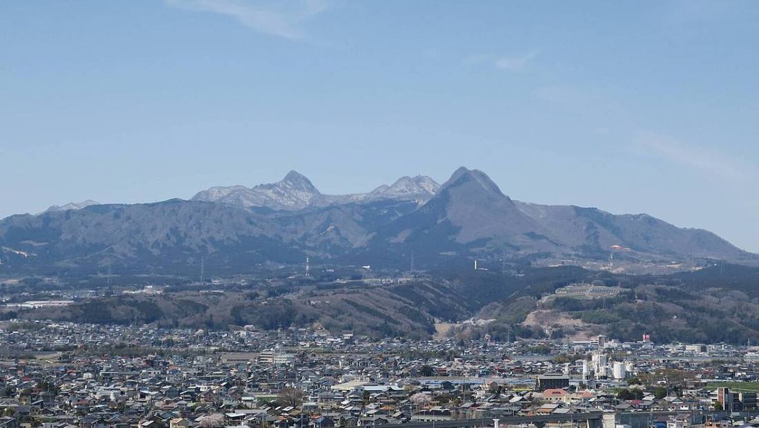
Photo: photo: Qurren (トーク) Taken with Canon PowerShot G9 X / CC BY-SA 4.0 · Wikimedia Commons
Gunma Prefecture
Kanto region · Prefecture
Official website
Gunma is a "hot spring kingdom" with many famous onsen (hot springs), such as Kusatsu, Ikaho and Shima. It once prospered from sericulture (silkworm raising) and silk reeling, and Tomioka Silk Mill is a World Heritage Site that symbolizes the modernization of Japan. Gunma is also known for growing konjac potatoes.
- Kusatsu Onsen
- Tomioka Silk Mill (World Cultural Heritage Site)
- Konjac
- Karakkaze (the dry winter wind of Joshu)
Key facts
- Municipalities
- 35 (12 cities, 15 towns, 8 villages)
Source: Statistics Bureau of Japan, 2025 Population Census (population, area and density); area from the Geospatial Information Authority of Japan (GSI), Area Statistics of Prefectures and Municipalities (2025). National ranks are among the 47 prefectures, ordered by this site from these values.
Places to know
- Kusatsu Town The Yubatake (hot water field), where abundant hot spring water flows out.
- Takasaki City A producer of daruma dolls and a transport hub.
- Minakami Town A mountain resort with Mt. Tanigawa, rafting and hot springs.
Current warnings, advisories and earthquakes
Places to visit in Gunma Prefecture
 Museum · Tomioka City, GunmaTomioka Silk Millsilk reeling factory in Tomioka, Gunma prefecture, Japan
 Place of scenic beauty · Tomioka City, GunmaMt. Myogimountain in Gunma Prefecture, Japan
 Hot spring (onsen) · Kusatsu Town, GunmaKusatsu Onsenbuilding in Gunma Prefecture, Japan
 Castle · Takasaki CityMinowa Castlebuilding in Takasaki, Gunma Prefecture, Japan
 Castle · Numata City, GunmaNumata Castle
 Special historic site · Takasaki CityTago Stelestone memorial in Japan
 Historic site · Midori CityIwajuku Sitepaleolithic site in Japan
 Castle · Minakami TownNagurumi Castlecastle ruins in Tone, Japan
 Castle · Higashiagatsuma TownIwabitsu Castlebuilding in Higashiagatsuma, Gunma Prefecture, Japan
 Waterfall · Numata City, GunmaFukiware Fallswaterfall in Numata city, Gunma prefecture, Japan
Browse by category
Shrines, temples, castles and historic sites
Chosen automatically, most popular first, from landmarks and cultural properties registered in Wikidata (we have not checked whether each is open). Names and descriptions: Wikidata (CC0); photos: Wikimedia Commons (photographer and license under each photo).
National parks in Gunma Prefecture
Chosen by overlaying the park boundaries (Ministry of the Environment, Biodiversity Center of Japan, "National Park Areas" GIS data, updated April 28, 2025, combined and simplified by NIPPON ATLAS) with municipal boundaries (National Land Numerical Information, January 2021), keeping overlaps of about 0.5 km² or more (approximate). Areas are the land areas from the Ministry of the Environment, "Overview of National Parks" (April 10, 2026). All national parks
Municipalities in Gunma Prefecture (35)
| Municipality | Population | 5-year change | Area | Temperature nownearest AMeDAS |
|---|
| Maebashi City | 324,191 | −2.4% | 312 km² | |
| Takasaki City | 363,477 | −2.5% | 459 km² | |
| Kiryu City | 97,127 | −8.8% | 274 km² | |
| Isesaki City | 208,069 | −1.8% | 139 km² | |
| Ota City | 219,322 | −1.7% | 176 km² | |
| Numata City | 41,187 | −9.2% | 443 km² | |
| Tatebayashi City | 72,780 | −3.4% | 60.97 km² | |
| Shibukawa City | 70,265 | −5.8% | 240 km² | |
| Fujioka City | 59,416 | −6.1% | 180 km² | |
| Tomioka City | 43,771 | −7.7% | 123 km² | |
| Annaka City | 50,840 | −7.4% | 276 km² | |
| Midori City | 47,420 | −4.5% | 208 km² | |
| Shinto Village | 14,116 | −0.7% | 27.92 km² | |
| Yoshioka Town | 22,885 | +5.0% | 20.46 km² | |
| Ueno Village | 970 | −14.0% | 182 km² | |
| Kanna Town | 1,317 | −19.9% | 115 km² | |
| Shimonita Town | 5,492 | −16.5% | 188 km² | |
| Nanmoku Village | 1,260 | −21.8% | 119 km² | |
| Kanra Town | 11,938 | −4.4% | 58.61 km² | |
| Nakanojo Town | 13,914 | −9.6% | 439 km² | |
| Naganohara Town | 4,839 | −5.0% | 134 km² | |
| Tsumagoi Village | 8,164 | −7.8% | 338 km² | |
| Kusatsu Town | 5,753 | −4.9% | 49.75 km² | |
| Takayama Village | 3,097 | −11.8% | 64.18 km² | |
| Higashiagatsuma Town | 11,237 | −11.7% | 254 km² | |
| Katashina Village | 3,543 | −11.3% | 392 km² | |
| Kawaba Village | 3,154 | −9.4% | 85.25 km² | |
| Showa Village | 6,689 | −3.8% | 64.14 km² | |
| Minakami Town | 15,740 | −8.5% | 781 km² | |
| Tamamura Town | 35,004 | −2.9% | 25.78 km² | |
| Itakura Town | 12,655 | −10.1% | 41.86 km² | |
| Meiwa Town | 10,291 | −5.4% | 19.64 km² | |
| Chiyoda Town | 10,334 | −4.9% | 21.73 km² | |
| Oizumi Town | 41,417 | −1.6% | 18.03 km² | |
| Ora Town | 24,260 | −4.9% | 31.11 km² | |
Source: Statistics Bureau of Japan, 2025 Population Census (population in 2025; change compared with 2020). Area: GSI (2025). Designated cities are shown as one city (wards combined). "Temperature now" is the latest JMA AMeDAS observation (preliminary) at the nearest station in the same prefecture, loaded and shown unchanged when you open the page.