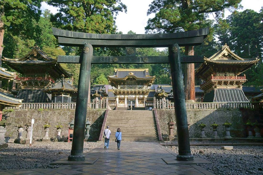
Photo: Koichi Sato / CC BY-SA 4.0 · Wikimedia Commons
Tochigi Prefecture
Kanto region · Prefecture
Official website
Tochigi has the largest strawberry harvest in Japan. World Heritage sites, led by Nikko Toshogu Shrine, and the hot springs and highland resorts of Nasu and Kinugawa are all a short distance from the Tokyo area.
- Strawberries (Tochiotome)
- Shrines and Temples of Nikko (World Cultural Heritage Site)
- Gyoza (dumplings)
- Mashiko ware (pottery)
Key facts
- Municipalities
- 25 (14 cities, 11 towns)
Source: Statistics Bureau of Japan, 2025 Population Census (population, area and density); area from the Geospatial Information Authority of Japan (GSI), Area Statistics of Prefectures and Municipalities (2025). National ranks are among the 47 prefectures, ordered by this site from these values.
Places to know
- Utsunomiya City The prefectural capital, known across Japan as a city of gyoza (dumplings).
- Nikko City Toshogu Shrine, Kegon Falls, Lake Chuzenji and Kinugawa Onsen.
- Nasu Town A highland resort with an imperial villa.
Current warnings, advisories and earthquakes
Places to visit in Tochigi Prefecture
 Shinto shrine · Nikko CityNikko Tosho-guShinto shrines in Tochigi Prefecture, Japan
 Waterfall · Nikko CityKegon Fallswaterfall in Nikkō National Park, Tochigi Prefecture, Japan
 Shinto shrine · Nikko CityFutarasan ShrineShinto shrine in Tochigi Prefecture, Japan
 Buddhist temple · Nikko CityRinno-ji TempleBuddhist temple in Tochigi Prefecture, Japan
 Lake · Nikko CityLake Chuzenjilake in Nikkō, Kantō region, Japan
 Place of scenic beauty · Nasu TownSessho-sekiobject in Japanese mythology
 Amusement park · Motegi TownMobility Resort MotegiMotorsport track in Japan
 Historic site · Nikko CityShrines and Temples of NikkoUNESCO World Heritage Site in Kantō region, Japan
- Historic site · Nikko CityAshio Copper Mineformer mine in Japan
 Buddhist temple · Ashikaga CityBanna-ji TempleBuddhist temple in Ashikaga, Tochigi prefecture, Japan
Browse by category
Shrines, temples, castles and historic sites
Chosen automatically, most popular first, from landmarks and cultural properties registered in Wikidata (we have not checked whether each is open). Names and descriptions: Wikidata (CC0); photos: Wikimedia Commons (photographer and license under each photo).
National parks in Tochigi Prefecture
Chosen by overlaying the park boundaries (Ministry of the Environment, Biodiversity Center of Japan, "National Park Areas" GIS data, updated April 28, 2025, combined and simplified by NIPPON ATLAS) with municipal boundaries (National Land Numerical Information, January 2021), keeping overlaps of about 0.5 km² or more (approximate). Areas are the land areas from the Ministry of the Environment, "Overview of National Parks" (April 10, 2026). All national parks
Municipalities in Tochigi Prefecture (25)
| Municipality | Population | 5-year change | Area | Temperature nownearest AMeDAS |
|---|
| Utsunomiya City | 511,237 | −1.4% | 417 km² | |
| Ashikaga City | 135,808 | −6.2% | 178 km² | |
| Tochigi City | 148,147 | −4.8% | 332 km² | |
| Sano City | 109,731 | −5.6% | 356 km² | |
| Kanuma City | 89,319 | −5.0% | 491 km² | |
| Nikko City | 71,574 | −7.8% | 1,450 km² | |
| Oyama City | 165,404 | −0.8% | 172 km² | |
| Mooka City | 75,793 | −3.1% | 167 km² | |
| Otawara City | 68,384 | −5.1% | 354 km² | |
| Yaita City | 28,874 | −7.4% | 170 km² | |
| Nasushiobara City | 112,455 | −2.4% | 593 km² | |
| Sakura City | 44,161 | −0.8% | 126 km² | |
| Nasukarasuyama City | 22,137 | −11.0% | 174 km² | |
| Shimotsuke City | 58,962 | −0.9% | 74.59 km² | |
| Kaminokawa Town | 29,737 | −3.5% | 54.39 km² | |
| Mashiko Town | 20,113 | −8.2% | 89.40 km² | |
| Motegi Town | 10,520 | −11.5% | 173 km² | |
| Ichikai Town | 10,514 | −6.6% | 64.25 km² | |
| Haga Town | 14,801 | −1.1% | 70.16 km² | |
| Mibu Town | 38,035 | −3.6% | 61.06 km² | |
| Nogi Town | 24,528 | −1.5% | 30.27 km² | |
| Shioya Town | 9,095 | −12.2% | 176 km² | |
| Takanezawa Town | 28,454 | −2.7% | 70.87 km² | |
| Nasu Town | 22,187 | −7.4% | 372 km² | |
| Nakagawa Town | 13,359 | −12.2% | 193 km² | |
Source: Statistics Bureau of Japan, 2025 Population Census (population in 2025; change compared with 2020). Area: GSI (2025). Designated cities are shown as one city (wards combined). "Temperature now" is the latest JMA AMeDAS observation (preliminary) at the nearest station in the same prefecture, loaded and shown unchanged when you open the page.