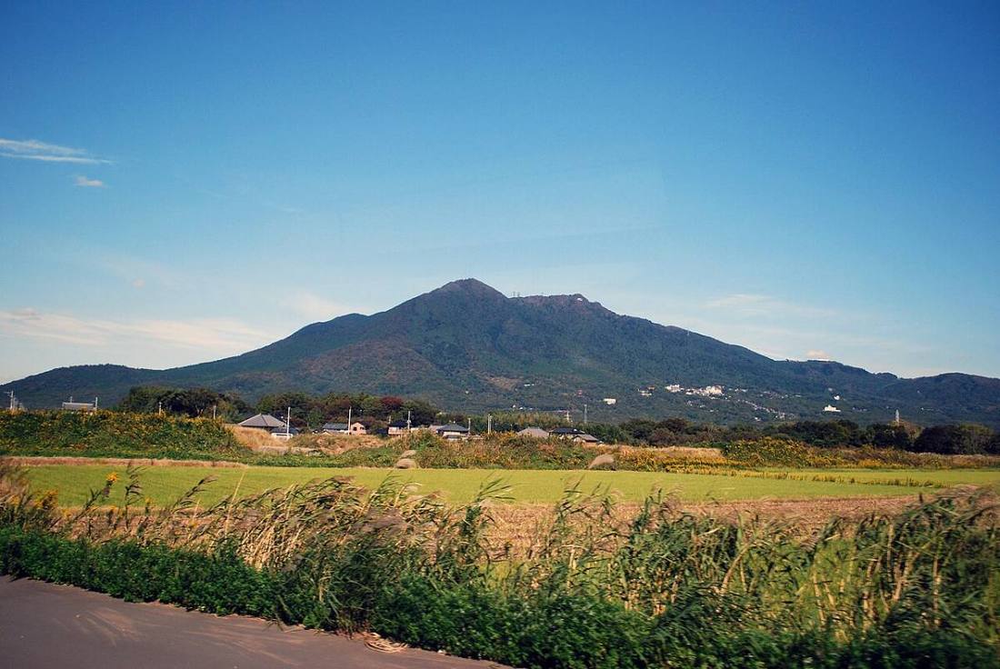
Photo: Polimerek / CC BY-SA 3.0 · Wikimedia Commons
Ibaraki Prefecture
Kanto region · Prefecture
Official website
Ibaraki is among the top prefectures in Japan for agricultural output. It has the largest harvests of melons and lotus roots in Japan and is also known for producing hoshi-imo (dried sweet potatoes). Tsukuba Science City brings together national research institutes, and Hitachi is the birthplace of Japan's heavy electrical industry.
- Natto (fermented soybeans)
- Melons and hoshi-imo (dried sweet potatoes)
- Tsukuba Science City
- Kairakuen
Key facts
- Municipalities
- 44 (32 cities, 10 towns, 2 villages)
Source: Statistics Bureau of Japan, 2025 Population Census (population, area and density); area from the Geospatial Information Authority of Japan (GSI), Area Statistics of Prefectures and Municipalities (2025). National ranks are among the 47 prefectures, ordered by this site from these values.
Places to know
- Mito City Kairakuen, one of the Three Great Gardens of Japan, and Mito natto.
- Tsukuba City A science city with many research institutes and universities.
- Hitachinaka City Hitachi Seaside Park, a national government park famous for nemophila flowers.
Current warnings, advisories and earthquakes
Places to visit in Ibaraki Prefecture
 Lake · Kasumigaura CityLake Kasumigauralake in Ibaraki Prefecture, Kantō region, Japan
 Shinto shrine · Kashima City, IbarakiKashima JinguShinto shrine in Kashima, Ibaraki prefecture, Japan
 Garden · Mito CityKairaku-enOne of Japan's top 3 gardens
 Museum · Mito CityKodokanformer han school in Mito, Japan
 Waterfall · Daigo TownFukuroda Fallswaterfall in Daigo, Kuji district, Ibaraki prefecture, Japan
 Garden · Hitachinaka CityHitachi Seaside Parkpublic park in Hitachinaka, Ibaraki, Japan
 Shinto shrine · Kasama CityKasama Inari ShrineShinto shrine in Ibaraki Prefecture, Japan
 Castle · Mito CityMito CastleJapanese castle located in Mito, Ibaraki Prefecture
 Garden · Hitachiota CitySeizansoresidence in Hitachiōta, Ibaraki, Japan
 Amusement park · Chikusei CityThe Hirosawa City
Browse by category
Shrines, temples, castles and historic sites
Chosen automatically, most popular first, from landmarks and cultural properties registered in Wikidata (we have not checked whether each is open). Names and descriptions: Wikidata (CC0); photos: Wikimedia Commons (photographer and license under each photo).
Municipalities in Ibaraki Prefecture (44)
| Municipality | Population | 5-year change | Area | Temperature nownearest AMeDAS |
|---|
| Mito City | 265,692 | −1.8% | 217 km² | |
| Hitachi City | 158,681 | −9.1% | 226 km² | |
| Tsuchiura City | 141,509 | −0.4% | 123 km² | |
| Koga City | 136,253 | −2.2% | 124 km² | |
| Ishioka City | 67,339 | −7.8% | 216 km² | |
| Yuki City | 48,145 | −4.9% | 65.76 km² | |
| Ryugasaki City | 73,904 | −3.3% | 78.59 km² | |
| Shimotsuma City | 40,750 | −4.2% | 80.88 km² | |
| Joso City | 57,918 | −4.8% | 124 km² | |
| Hitachiota City | 43,769 | −9.9% | 372 km² | |
| Takahagi City | 25,001 | −9.7% | 194 km² | |
| Kitaibaraki City | 38,386 | −8.2% | 187 km² | |
| Kasama City | 71,424 | −2.4% | 240 km² | |
| Toride City | 103,381 | −1.1% | 69.94 km² | |
| Ushiku City | 82,508 | −2.5% | 58.92 km² | |
| Tsukuba City | 268,832 | +11.2% | 284 km² | |
| Hitachinaka City | 151,618 | −3.2% | 101 km² | |
| Kashima City | 63,954 | −4.5% | 106 km² | |
| Itako City | 25,158 | −8.9% | 71.40 km² | |
| Moriya City | 70,199 | +2.6% | 35.71 km² | |
| Hitachiomiya City | 35,708 | −9.1% | 348 km² | |
| Naka City | 51,527 | −3.7% | 97.82 km² | |
| Chikusei City | 94,761 | −5.9% | 205 km² | |
| Bando City | 51,306 | −1.8% | 123 km² | |
| Inashiki City | 35,353 | −9.4% | 206 km² | |
| Kasumigaura City | 38,396 | −4.2% | 157 km² | |
| Sakuragawa City | 35,256 | −9.9% | 180 km² | |
| Kamisu City | 93,309 | −2.2% | 147 km² | |
| Namegata City | 29,212 | −9.2% | 222 km² | |
| Hokota City | 43,331 | −5.7% | 208 km² | |
| Tsukubamirai City | 52,100 | +4.5% | 79.16 km² | |
| Omitama City | 46,714 | −4.4% | 145 km² | |
| Ibaraki Town | 29,429 | −6.3% | 122 km² | |
| Oarai Town | 14,444 | −8.1% | 23.89 km² | |
| Shirosato Town | 16,373 | −9.5% | 162 km² | |
| Tokai Village | 37,783 | −0.3% | 38.01 km² | |
| Daigo Town | 13,698 | −13.0% | 326 km² | |
| Miho Village | 13,585 | −7.0% | 66.61 km² | |
| Ami Town | 49,667 | +2.3% | 71.40 km² | |
| Kawachi Town | 7,149 | −13.1% | 44.30 km² | |
| Yachiyo Town | 20,090 | −4.5% | 58.99 km² | |
| Goka Town | 7,507 | −7.2% | 23.11 km² | |
| Sakai Town | 23,885 | −1.3% | 46.59 km² | |
| Tone Town | 14,852 | −3.2% | 24.86 km² | |
Source: Statistics Bureau of Japan, 2025 Population Census (population in 2025; change compared with 2020). Area: GSI (2025). Designated cities are shown as one city (wards combined). "Temperature now" is the latest JMA AMeDAS observation (preliminary) at the nearest station in the same prefecture, loaded and shown unchanged when you open the page.